
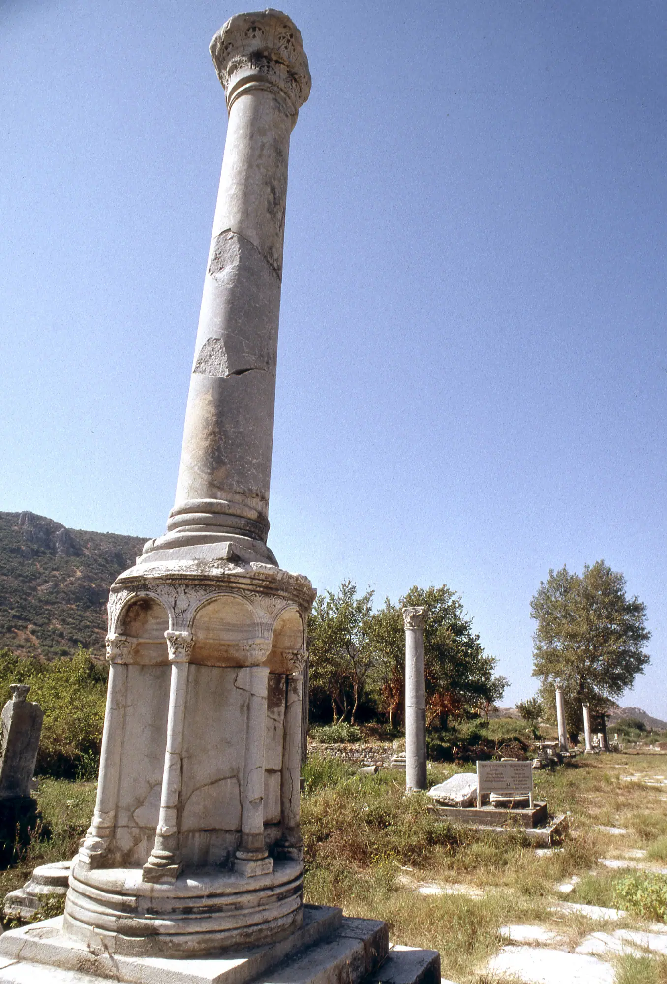
Harbour Street — the Arkadiane — ran dead straight from the foot of the Great Theatre to the quay of the Roman harbour. Along its length a four-column monument, a tetrapylon, marked a side-street crossing, on the model of similar monuments on Antioch’s own colonnaded streets, according to the 1905 excavation report1. Carved on the underside of a lintel stone in a storeroom behind its north colonnade was found the apocryphal correspondence between Christ and King Abgar of Edessa, cut in careful lettering, the same report records2. The street was lit after dark, unusually for antiquity: thirteen lamps, probably torches set in metal brackets, a real rarity given how readily harbour districts drew shady characters once the sun went down, per Elliger3. Under Justinian, statues of the four Evangelists went up on great columns along its length, together with a fountain near the Stadium, Foss records4.
Exactly how long the avenue ran is not settled. Published figures cluster into two camps rather than one outlying number: around 600 m, from Elliger’s study, the 1905 excavation report and Dey’s more recent work, against around 500 m from Puelz and from Ladstätter & Magdalino. Both clusters are given here rather than a single figure picked between them5. At the street’s western end, the early-imperial Harbour Gate opened onto the quay through three passages, each flanked by eight columns pressed decoratively against the wall — columns with no real structural depth of their own, Elliger notes6.

Whose baths? A correction
The great bath-gymnasium complex beside Harbour Street has long carried the name “Baths of Constantine,” a label the site’s own text has previously called unreliable. That caution was right, but the attribution itself is not unresolved any longer: three independent sources — Foss, Hanslmayr’s 2016 excavation report and Steskal & La Torre’s 2008 report — agree that the late-antique patron was Constantius II, acting through the proconsul Lucius Caelius Montius, and that the complex was known in Late Antiquity as the Thermae Constantianae7. What was long thought is the vague “Constantine” label; what is now argued, on three independent readings of the same evidence, is a specific emperor and a specific official who built in his name. The correction is offered here as an explained change, not a silent swap.
The baths themselves were large by any Ephesian standard: about 70,000 m² on one source’s figure, part of an overall complex — including the Portico of Verulanus, itself over 200 m square and larger than any comparable portico in the city — that together covered roughly 500 by 300 m, the biggest single footprint of public building anywhere in Ephesus8.
Keeping the harbour open
A working harbour needed constant upkeep, and Ephesus’s civic and Roman authorities record that upkeep in detail. Tacitus records that in AD 66 the proconsul Barea Soranus had the harbour basin cleaned — an act of civic munificence that only increased the emperor Nero’s hostility toward him, and Soranus was later forced to suicide9. A little over eighty years later, proconsul L. Antonius Albus’s edict of AD 146/47 (IvE 23, now displayed in the Ephesus Museum at Selçuk) specifically forbids timber importers from stacking wood on the quay, because the weight damages the piers, and bans stone-sawers from silting the channel with grit — both known from Rogers’s discussion and from Wankel’s original epigraphic edition of the text10. An undated decree set up at the harbour also prohibited people from bearing arms there; Foss suggests it may date to the reign of Valens, when a similar ban was decreed empire-wide11.
Ephesus’s need to keep dredging was not a passing problem. Foss traces how the original harbour near the Artemision silted first, prompting Lysimachus’s move of the city to begin with; the same problem recurred at the new site, and kept recurring, requiring constant dredging and punitive measures from the reign of Attalus II through into the early 3rd century AD12. Later benefaction is less certain: an early-3rd-century benefactor, M. Fulvius Publicianus Nikephoros, is named by Rogers as having subsidised the harbour’s southern gate specifically, though whether this was a repair of an already-standing gate or the gate’s actual construction date remains an open question this page has not been able to resolve13. There is also an unresolved tension in the record around the mid-3rd century: an earthquake, probably around AD 262, is said by Rogers to have destroyed the Serapeion precinct and collapsed the lower agora complex, after which no benefactor was able to resume the periodic dredging, so the harbour became progressively unusable for ship traffic14.
The fishery customs house
Not every structure on Harbour Street served emperors or proconsuls. A fishery-and-customs toll house, recorded in the inscription IvE 20, was funded and dedicated in the mid-1st century AD, between AD 54 and 59, by Ephesus’s own fishermen and fish-dealers — a trade guild paying to formalise, and presumably to profit from, the tolls on its own catch, according to Wankel’s edition of the inscription15. It is a small, human-scale counterpart to the imperial edicts on dredging and quay maintenance: ordinary tradespeople investing in the harbour infrastructure that kept their business running.

A harbour with a long afterlife
The popular version of this story ends abruptly: the harbour silted up in antiquity, full stop, with the story sometimes tied to a single event, the AD 726 eruption of Santorini, on the evidence of pumice found in beach ridges nearby. That single-event picture does not hold up. Foss himself already disputed the 726 dating on textual grounds, and the fuller evidence assembled since settles the point further: amphora finds show intensive harbour activity in the Roman basin continuing to the early 7th century, a harbour at Çanakgöl Tepe operated through the rest of Late Antiquity, and a harbour at Pamucak operated from at least the 11th century — with supporting tobacco-pipe evidence — into the 17th. The last Ottoman documentary mention of “the harbour of Ayasoluk” comes as late as 1622–162316. Read together, these facts describe a working harbour of some kind, relocating between three different sites, for roughly a millennium after the classical harbour first silted — not a single sharp ending.
The transition was gradual rather than a single collapse. Byzantine walls of the 7th–8th century still reached the harbour’s edge, with a protective tower, showing it still functioned then, Foss notes17. By the early 9th century, though, it no longer served the Byzantine fleet, which sailed from Phygela instead — and by the 10th century, silting had made the old harbour unusable for the fleet altogether: both great Byzantine expeditions to reconquer Crete, the failed attempt of 903 and the victorious one of 961, sailed from Phygela rather than Ephesus, he adds18.
Even before that decline, large vessels could not always reach the basin directly. Ladstätter and Magdalino write that at the end of the 2nd century AD, Titus Flavius Damianus built offshore anchorages for large ships, whose cargo and passengers were then transferred onto smaller barques and brought in via the canal to the Roman harbour basin — the same transfer practice Cyril of Alexandria is said to have used on his own arrival for the Council of Ephesus in AD 43119. That council, they note, is reported to have favoured Ephesus partly for its communications, reachable, as the record puts it, "by land and by sea"20. Long after, around 1106, the Russian pilgrim Abbot Daniel, sailing from Chios to Ephesus on his way to Jerusalem, recorded visiting a harbour among the city’s pilgrim attractions, naming it, in Russian, for the spot where St John the Evangelist was said to have been miraculously washed ashore21 — a working port, still, four centuries after the classical harbour’s supposed single end.
The form of the Port is clearly defined by the tall bullrushes which now cover nearly the whole area, leaving only a small patch of water on the south side, near the centre, which is always clear and fresh, being probably supplied by one of the numerous springs which abound at Ephesus.
Wood, excavating in the 1860s and 70s, found the classical harbour already reduced to a marsh of bullrushes tracing its old outline — a 19th-century snapshot of the very silting this page describes, taken centuries after the working port had already moved elsewhere.
Where was the medieval port?
Foss himself once identified the medieval Turkish-era port, on the strength of a 1490 Venetian portolan chart, as the ancient site of Panormos, about four miles west of Ayasuluk. That identification is now superseded: a re-reading of the portolan’s six topographic clues — distance, the shape of the embayment, the docks, a hilltop tower, a steep cape — points unambiguously instead to Pamucak Harbour, not Panormos22.
A separate, rival identification for Panormos itself remains a live and unresolved disagreement rather than a settled fact. Recep Meriç proposed that Panormos Harbour instead lay in the north-western alluvial plain near Alaman Gölü, citing a spolia-built causeway there that he dated to the 14th century as its approach road. That reading is directly disputed within the same body of scholarship: the 17th-century traveller Thomas Smith described crossing that same causeway on the ordinary Izmir-to-Ephesus road, suggesting it was simply part of the everyday road across the marsh rather than a purpose-built harbour approach. Both readings are set out here; neither is adopted as the answer23.
From the theatre above, Harbour Street still points, dead straight, at the green plain where all of this once lay under open water. The rest of the Roman city it served is mapped out on the ancient city, the theatre it runs from is covered on the Great Theatre page, and the harbour’s earlier chapters belong to the wider history of Ephesus.
Sources
Each source is listed once. The numbers link back to the claims it supports; dates show when the source was checked.
- Institut 1905, 133 1, 2
- Elliger 1985, 180 3
- Foss 1979, 99 4
- Dey 2015, 91 5
- Elliger 1985, 179 5
- Institut 1905, 64 5
- Ladstätter and Magdalino 2019, 36 5
- Pülz 2010, 132 5
- Elliger 1985, 65 6
- Foss 1979, 59 7
- Foss 1979, 60 7, 8
- Hanslmayr 2016, 19 7
- Steskal and Torre 2008, 2 7, 8
- Rogers 2012, 418 9, 10
- Wankel 1979, 143 10
- Foss 1979, 17 11
- Foss 1979, 185 12, 17
- Rogers 2012, 343 13
- Rogers 2012, 419 14
- Wankel 1979, 128 15
- Foss 1979, 186 16
- Ladstätter and Magdalino 2019, 122 16
- Ladstätter and Magdalino 2019, 135 16, 23
- Foss 1979, 123 18
- Ladstätter and Magdalino 2019, 119 19, 20
- Ladstätter and Magdalino 2019, 121 21
- Foss 1979, 149 22
- Ladstätter and Magdalino 2019, 133 22