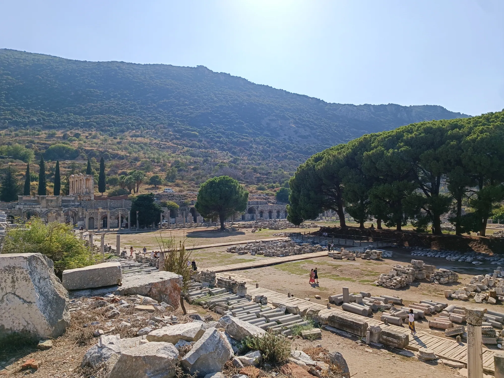
The ruins at Ephesus are not the earliest chapter in the history of Ephesus. They are the city Lysimachus, one of Alexander’s successors, built on a new walled site between the hills of Panayırdağ and Bülbüldağ, away from the old settlement around the Temple of Artemis2. The move probably came in the early 3rd century BC, though no single year is secure3, and for centuries afterwards the Romans rebuilt on his plan.
The site slopes. A marble road drops from the upper city through the valley to the Library of Celsus4. Marble Street carries on to the Great Theatre5, and from there a colonnaded avenue once ran to the harbour6. Walking it top to bottom is the easiest way to see the place, and the sections below keep to that order.
Why are the ruins so far from the sea?
The Küçük Menderes, which the Greeks called the Kaystros, has been dropping silt at its mouth for about seven thousand years, and every harbour Ephesus built ended up stranded behind the new shoreline13. Any distance quoted for Ephesus depends on the point chosen. The Roman harbour canal alone ran about 4 km west of the basin, a Byzantine extension took it roughly 3 km further, and the old harbour is best described as several kilometres, probably 5–6 km, from today’s coast14.
The problem was old even in Lysimachus’s day. Geoarchaeologists read his move as partly practical: the harbour near the Artemision was already silting, while the bay between Pion and Preon still offered deep anchorage15. The Ephesians did not want to go, and Strabo has Lysimachus flush them out by stopping up the drains in a rainstorm16. He also renamed the city Arsinoeia after his wife, a name that lapsed when he died in 281 BC17.
Rome inherited the fight against the silt. One earlier attempt had made things worse: according to Strabo, a mole built for Attalus II of Pergamon to deepen the harbour mouth caught the mud instead18. Inscriptions record clearance after clearance from Nero’s reign to the mid-3rd century, including a ban on dumping into the harbour canal19. Once the basin below the city had been dredged into shape, the advancing delta forced the Romans to cut a long canal westwards to reach open water20. The basin itself survives as a small marshy lake21.

How the ruins are laid out
The Hellenistic city was planned on a regular grid22, inside walls that followed the ridge of Bülbüldağ over a length of more than 4 km8. One street ignores the grid entirely. Curetes Street cuts diagonally down the valley, and archaeologists take that as a sign that it is older than the plan, a processional route to Artemis that the new city had to accommodate23.
That route was still in use under Trajan. A decree of about AD 104 records the gift of Gaius Vibius Salutaris: a set of gold and silver images, an Artemis flanked by two stags among them, which were paraded from the Artemision to assemblies in the theatre, coming in through the Magnesian Gate and going out through the Coressian Gate24. Today’s walk joins the same two points, the Magnesian Gate and the theatre.
UNESCO’s criterion (iii) picks out four monuments here: Terrace House 2, the Serapeion, the Temple of Hadrian and the Library of Celsus25. Of the four components in the World Heritage property, the ancient city is by far the largest, at 614.76 ha11.
Which gate should you start from?
Starting at the Upper Gate means walking downhill, which is the main thing to settle when planning a visit. Ephesus has two entrances with ticket offices: the Upper Gate, south of the city, near the ancient Magnesian Gate, and the Lower Gate on the north side, towards Selçuk10. From the top the route drops through the upper city, down Curetes Street and past the library towards the theatre and the Lower Gate, the same order the Ephesus map follows. Starting at the bottom works too; it is the same walk uphill.
For cruise passengers the Lower Gate is the nearer one, about 19 km by road from the Kuşadası cruise port against about 23 km to the Upper Gate26. Those road distances shape the transfer from the Kuşadası cruise port, and the trains and roads from further afield are on getting to Ephesus.
The Magnesian Gate
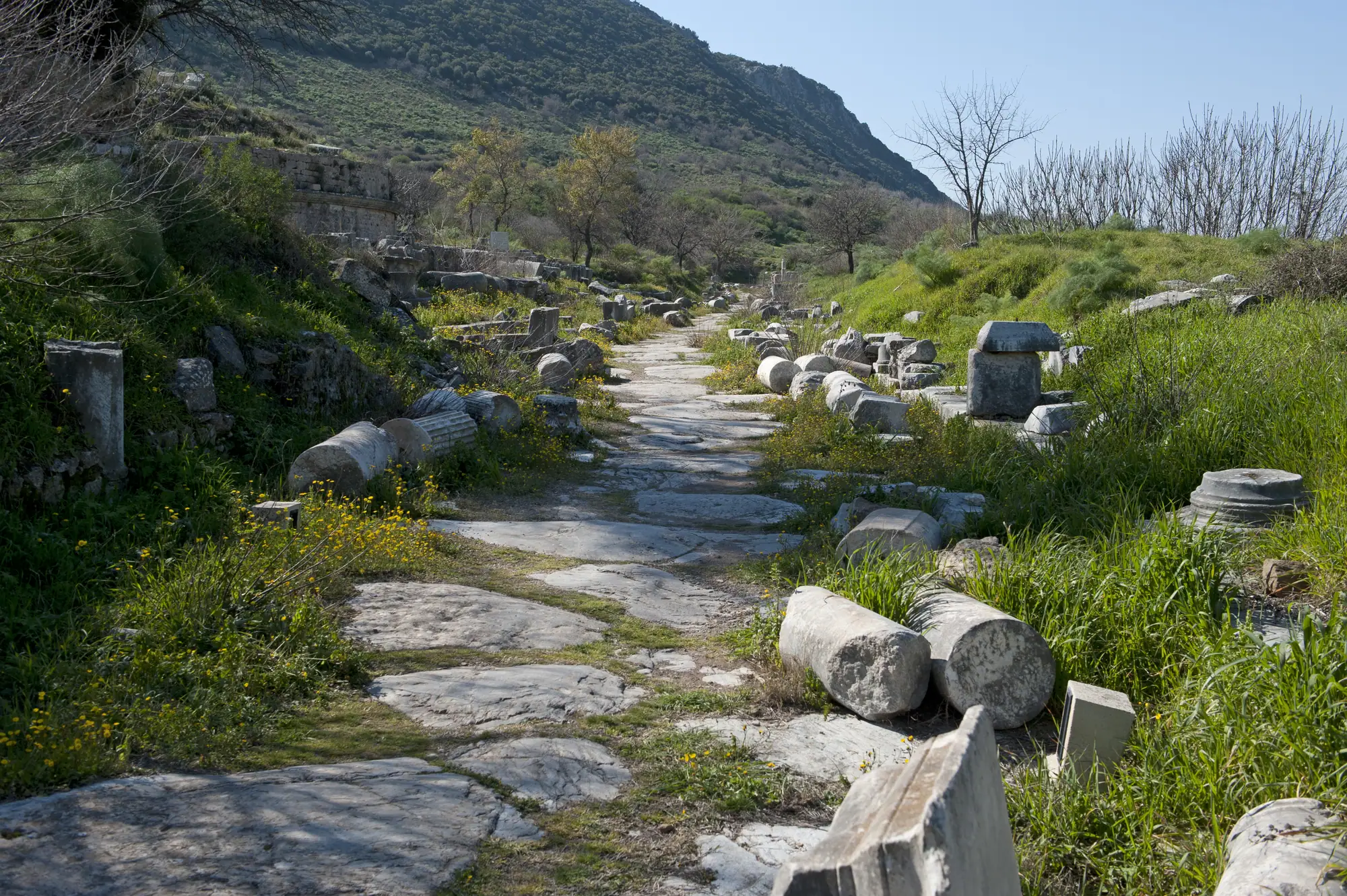
The largest gate of Ephesus stood on the road to Magnesia, some 300 m south of the modern upper entrance27. It was long assumed to belong to Lysimachus’s walls, until excavation in 2008–09 dated it to around 100 BC; it went on serving as a gate into late antiquity27. John Turtle Wood first uncovered it in 186927, having tracked the procession route described in the Salutaris inscription he had found at the theatre28.
The State Agora and the Basilike Stoa
The State Agora, sometimes called the Upper Agora, was the civic square of Roman Ephesus. Its open space, framed by halls, measured about 58 by 155 m, roughly 9,000 m², and it grew over ground that had held archaic graves29. Along its north side ran the Basilike Stoa, a hall about 167 m long dedicated in AD 11 by Gaius Sextilius Pollio and his family to Artemis Ephesia, Augustus, Tiberius and the city, with a dedication in Latin and Greek along the architrave30. Bulls’ heads decorated its Ionic capitals30.
The temple at the centre of the square was long called a Temple of Isis. That label is now doubted, and the building is read more cautiously as an Augustan sanctuary, perhaps of Divus Julius and Roma, perhaps of Augustus himself31. A sanctuary of that kind is attested at Ephesus: in 29 BC Octavian gave the Roman citizens of Asia leave to build one there32.

The Bouleuterion, or Odeon
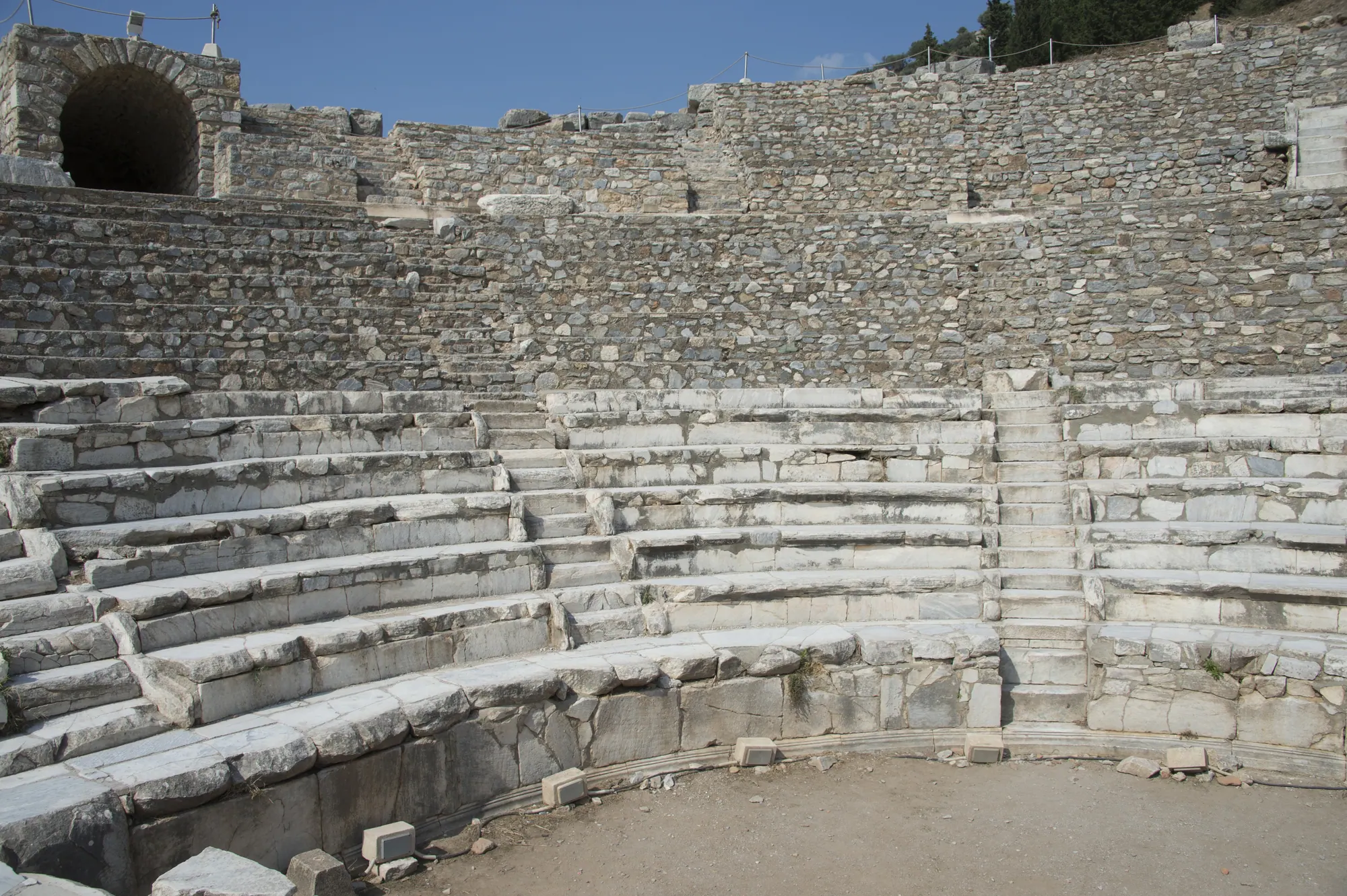
The Prytaneion and the statues of Artemis
The Prytaneion was the seat of the city’s executive and held the sacred hearth of Hestia. At Ephesus it was tended by the Curetes, priests linked to Artemis, and their names were inscribed on its columns35. The building visible today is Augustan, was renovated in the Severan period and had been demolished before about AD 40036. Franz Miltner’s team uncovered it in 1955–5637.
The Prytaneion’s most famous finds were buried inside it. In 1956 the excavators found Roman marble statues of Artemis Ephesia there: the “Colossal Artemis”, the “Beautiful Artemis” and a smaller figure38. The Colossal Artemis stands about 3 m high, wears a headdress of stacked temple façades and has lions, bulls and griffins on the panels of her skirt; her separately made hands are lost39. The Beautiful Artemis is a little later, 2nd century AD, unusually well preserved, with a deer at each side40. Both are in the Ephesus Museum at Selçuk, and both are Roman versions of the cult image, not the cult statue itself41.

Domitian Square and the Temple of the Sebastoi
A great artificial terrace nearby carried the temple once called the Temple of Domitian and now named the Temple of the Sebastoi, the emperors. Its dedication in AD 89/90 made Ephesus neokoros, official warden of an imperial-cult temple, for the first time42. The temple had eight by thirteen columns and stood over vaulted substructures that later served as an inscription museum, now closed43. Once Domitian’s memory had been condemned, the Flavian family as a whole took over the cult44.
A colossal marble head and forearm from its cult statue are in the Selçuk museum. The head is traditionally identified as Domitian, but many scholars now see Titus, and the standing figure is reckoned at about 7 m45.
Fountains and honorific monuments crowd the square. An inscription dates the Hydreion fountain to AD 198–211, the joint reign of Septimius Severus and Caracalla46. The Pollio Monument honours Gaius Sextilius Pollio, who paid for an aqueduct and the Basilike Stoa, and was erected by his stepson47. The marble Polyphemus group, of the 1st century BC, turned up at the Pollio fountain, although it had been made for the pediment of the temple in the State Agora; it too is now in the Selçuk museum48.

The Memmius Monument
Gaius Memmius, grandson of the dictator Sulla, consul in 34 BC and later governor of Asia, set up this monument under Augustus49. It honoured three generations of his family and recalled Sulla’s victory over Mithridates49, an awkward reminder in a city that had welcomed Mithridates in 88 BC and torn down Rome’s statues50.

The Hercules Gate
At the top of Curetes Street, reliefs of Herakles in his lion skin mark the Hercules Gate, a late antique structure that narrowed the street and closed it to wheeled traffic51. The reliefs themselves are older pieces, reused from the 2nd century51. From here on, Curetes Street was a street for people on foot.

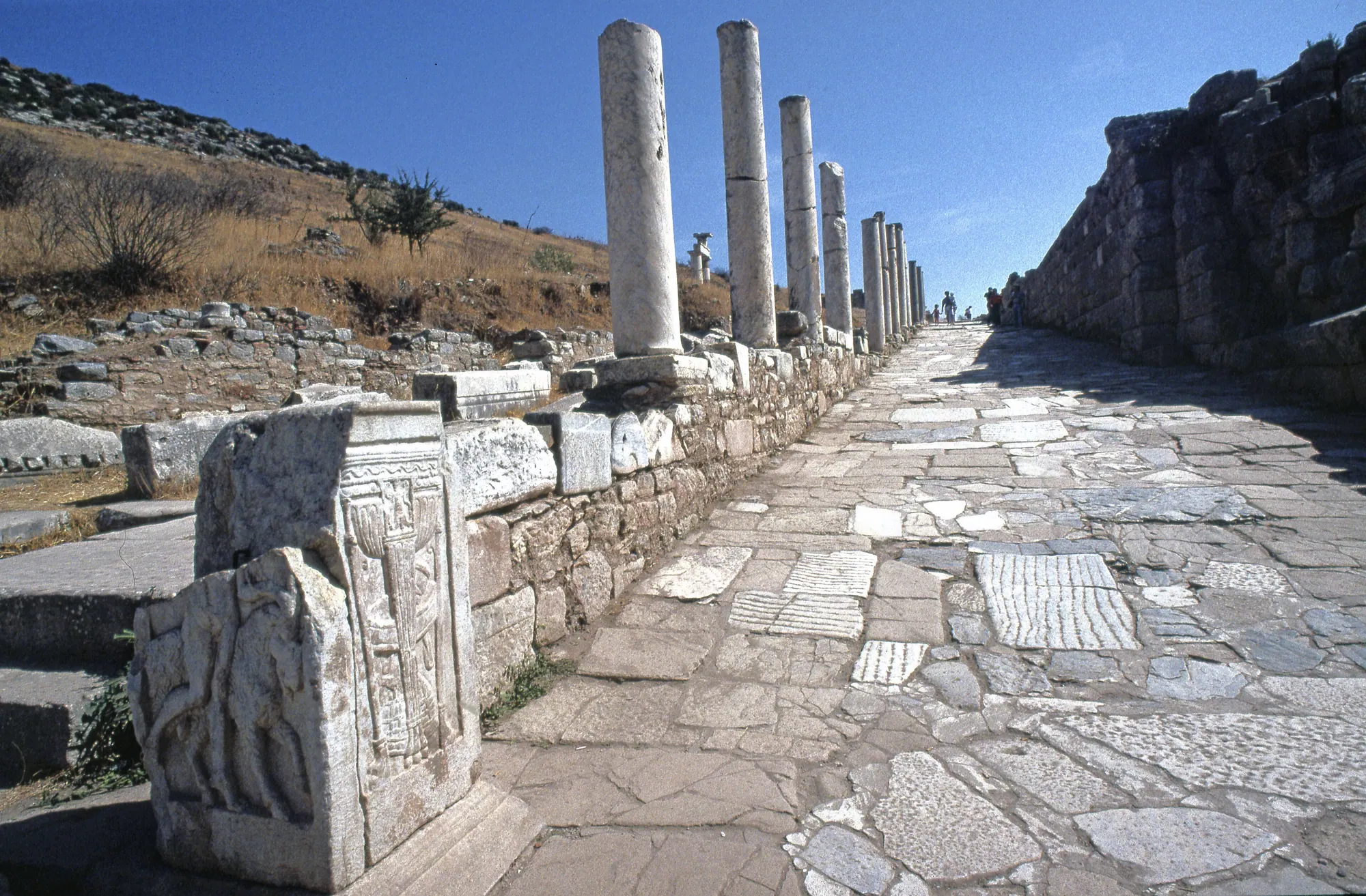
Curetes Street
Below the Hercules Gate the street runs down the valley floor as far as the library4. Its ancient name was probably Embolos, “the wedge”; the modern name comes from lists of Curetes priests, taken from the Prytaneion and found reused along the street52.
The most recent study gives its length as about 210–216 m. In its last phase the roadway was 6–8 m wide between colonnaded halls 3.5–5 m deep, and over its length it loses about 20 m of height, from roughly 30 m above sea level at the Hercules Gate to under 10 m at the library9. The lower part of the street has evidence reaching back to the 3rd century BC9.
What visitors see is a late Roman street patched after disaster. Earthquakes damaged it in the 3rd and 4th centuries, and after the 4th-century quake columns were brought in from other buildings, the Prytaneion among them53. At night, late antique inscriptions tell us, lamps lit the processional axis from Harbour Street up into this street54. Franz Miltner cleared it in the 1950s to join the monuments into a route for visitors, the moment Ephesus began to be shown as a landscape of ruins55.
The Fountain of Trajan
The Nymphaeum of Trajan was dedicated to Artemis and to Trajan by Tiberius Claudius Aristion and Julia Lydia Laterane, his wife, who also paid for a water channel 210 stadia long to feed it56. A stage-like front about 9.5 m high rose over a basin almost 12 m long and 5.5 m wide, and the central apse held a colossal Trajan, around 4 m tall if the surviving foot is any guide57. Only its base and feet remain on site57. Statues from the fountain, including Dionysus, a reclining satyr, Aphrodite, Androclus and Nerva, are in the Selçuk museum58.
Aristion was a figure of real standing. Pliny the Younger records a “Claudius Aristo”, the leading citizen of Ephesus, being acquitted of charges before Trajan59.

The Baths of Varius, or Scholastica Baths
Two names circulate for one building. Publius Quintilius Valens Varius built these baths in the late 1st century or the early years of the 2nd, and a Christian woman named Scholastikia paid for their renovation in the 4th or 5th60. Her headless seated statue still stands in the baths61. Architectural pieces from the demolished Prytaneion were built into them, which shows the Prytaneion had come down by the end of the 4th century or around 40062.
The latrine, and the house that was not a brothel
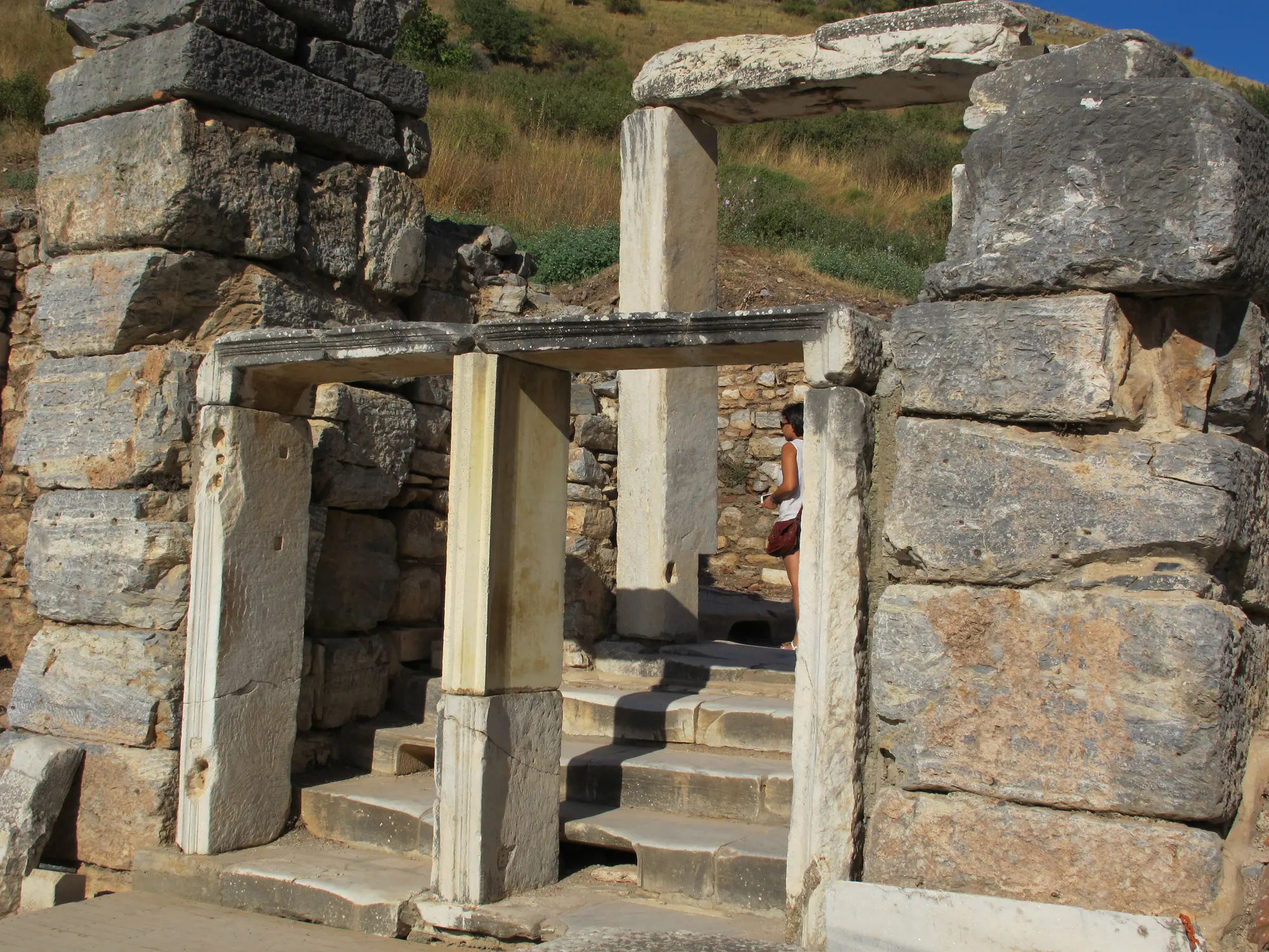
North-east of the corner where Marble Street meets Curetes Street is a public latrine of the 1st century AD. Its marble benches had seats over a flushing channel and were arranged around a central open pool63.
The house next to it is still sold to visitors as the brothel of Ephesus, one of the stories guidebooks get wrong. The idea goes back to Franz Miltner, who read the latrine’s building inscription in 1957 as evidence for a public brothel next door64. When Werner Jobst went over the evidence again, in 1976/77, he ruled that out65. A building survey in 2000–01 established what stood there instead: a peristyle house, first about 742.5 m² and then 879.5 m² once a vaulted reception suite and an apsed hall with a banquet mosaic were added, divided up in the end into workshops66.

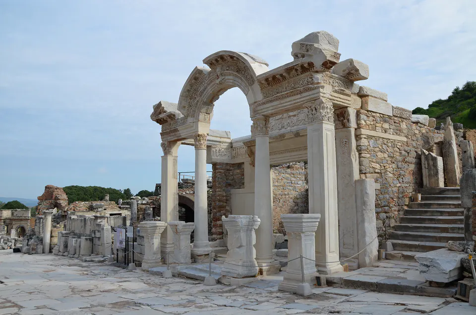
The Temple of Hadrian
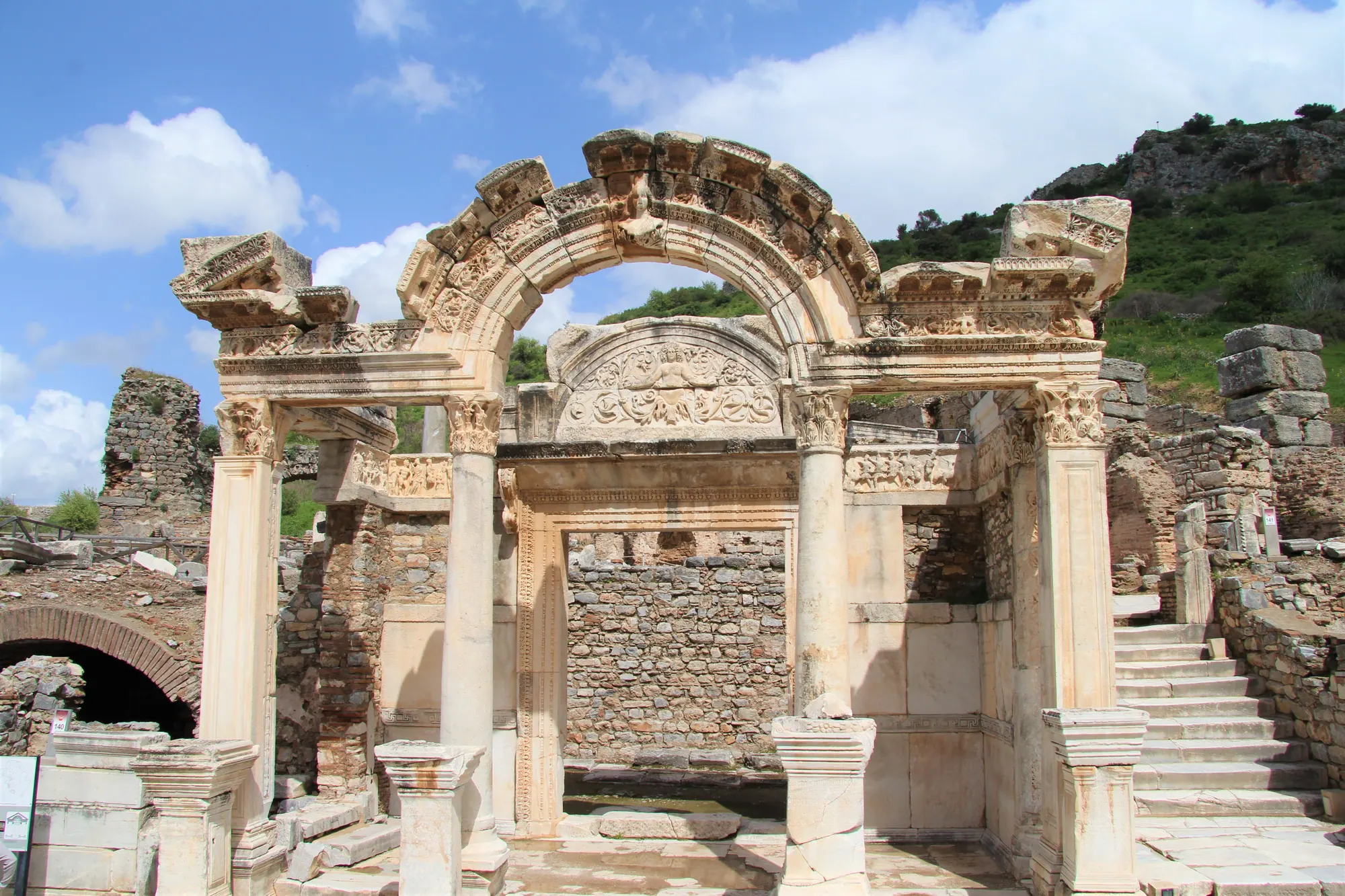
The small, richly carved front on Curetes Street is the so-called Temple of Hadrian. Publius Quintilius Valens Varius, the builder of the baths behind it, dedicated it with his wife and daughter to Artemis of Ephesus, to Hadrian and to the people67, and the temple and the baths were planned together68. Its porch has an arched lintel with a bust of Tyche on the keystone69.
Almost nothing about it is simple. The inscription is read as 117/118, but other accounts run as late as 13870, and whether the building was ever a temple of Hadrian at all is openly questioned71. The frieze in the porch is not Hadrianic but belongs to the 3rd or 4th century72, and the slabs on the building are casts of originals in the Selçuk museum73.
The Terrace Houses
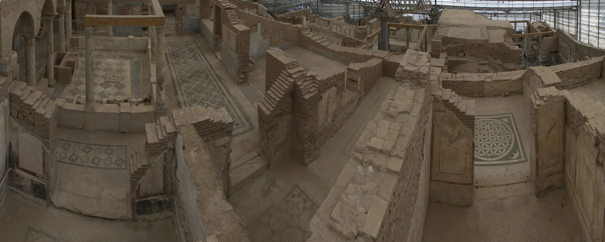
On the slope opposite the Temple of Hadrian, a modern roof covers Terrace House 2, a block of about 4,000 m²74. Behind its walls were six houses, later seven, each a peristyle house on three terraces75. Building began around the turn of the era, under Augustus and Tiberius76; a 3rd-century earthquake, in the third quarter of the century, ended its life as housing, and parts of it then held workshops and mills77.
The block keeps more 2nd- and 3rd-century wall painting than anywhere else in the Roman East, along with around a hundred mosaics and a great deal of marble wall cladding78. One unit belonged to a priest of Dionysus, Gaius Flavius Furius Aptus, who added marble banqueting halls around AD 120 and 15079. Scratched into the walls are drawings, poems and lists of everyday prices80. The houses have been open to visitors since the roof went up in 1999/200081.
The Terrace Houses need a ticket of their own. Combined 72-hour tickets pair them with the main site, and the larger combination adds the museum and St John’s: €52 / €6582 (checked on ).

The Octagon
The Octagon is an eight-sided marble tomb on Curetes Street, dated to the late 1st century BC; only its square base survives in place83. It was found in 1904, and in 1929 Josef Keil and Max Theuer opened the burial chamber and found a complete skeleton in a sarcophagus full of water84.
In 1990 Hilke Thür proposed that the tomb was that of Arsinoe IV, Cleopatra’s younger sister, whom Mark Antony had killed at Ephesus in 41 BC85. The octagonal plan recalled the Pharos of Alexandria, the date fitted, and Keil had judged the skull to be that of a young woman86. A 2009 facial reconstruction presented the individual as a woman of 15–17 with claimed African features87.
The skull was never lost in Germany during the Second World War, as some accounts still claim. It had been in Vienna all along, in the university’s anthropology collection under the label “Skull from Ephesus”, and was recognised there in December 202288. A study published in 2025 found a Y chromosome in both skull and thigh bone89: the remains are those of a boy aged 11–14, radiocarbon-dated to 205–36 BC, genetically closest to people of the Italian peninsula or Sardinia, with severe developmental disorders90. The authors rule Arsinoe out; why a Roman boy was given so prominent an Egypt-inspired monument is still unexplained91.
The base kept a public role long after the burial. In the 370s two imperial letters were inscribed on it, one on sharing the cost of the provincial festival among four cities, the other insisting that money from the imperial fund for renovating cities be spent as intended92.
The so-called Heroon of Androklos
Next to the Octagon is a U-shaped Hellenistic building of the 2nd century BC, later turned into a fountain; crosses carved on it in late antiquity gave it its old name, the Byzantine Fountain93. In 1995 Hilke Thür identified it as the shrine of Androclus, the legendary founder, using Pausanias’s description of his tomb, but many scholars doubt it: there is no burial chamber, and the early Ionian settlement lay elsewhere94.
Androclus himself belongs to tradition. In the foundation story an oracle promised that a fish and a boar would show him the site; a fish jumped out of the pan, the fire caught the scrub, a boar broke cover, and where he killed it the city was founded95. The same boar hunt is carved on the Temple of Hadrian’s frieze72.
A sarcophagus dug into the ground west of the Heroon in the late 5th or 6th century held an adult, a child and a marble portrait of an imperial priest; attempts to identify him with Tiberius Claudius Aristion, the builder of Trajan’s fountain, cannot be proven96.
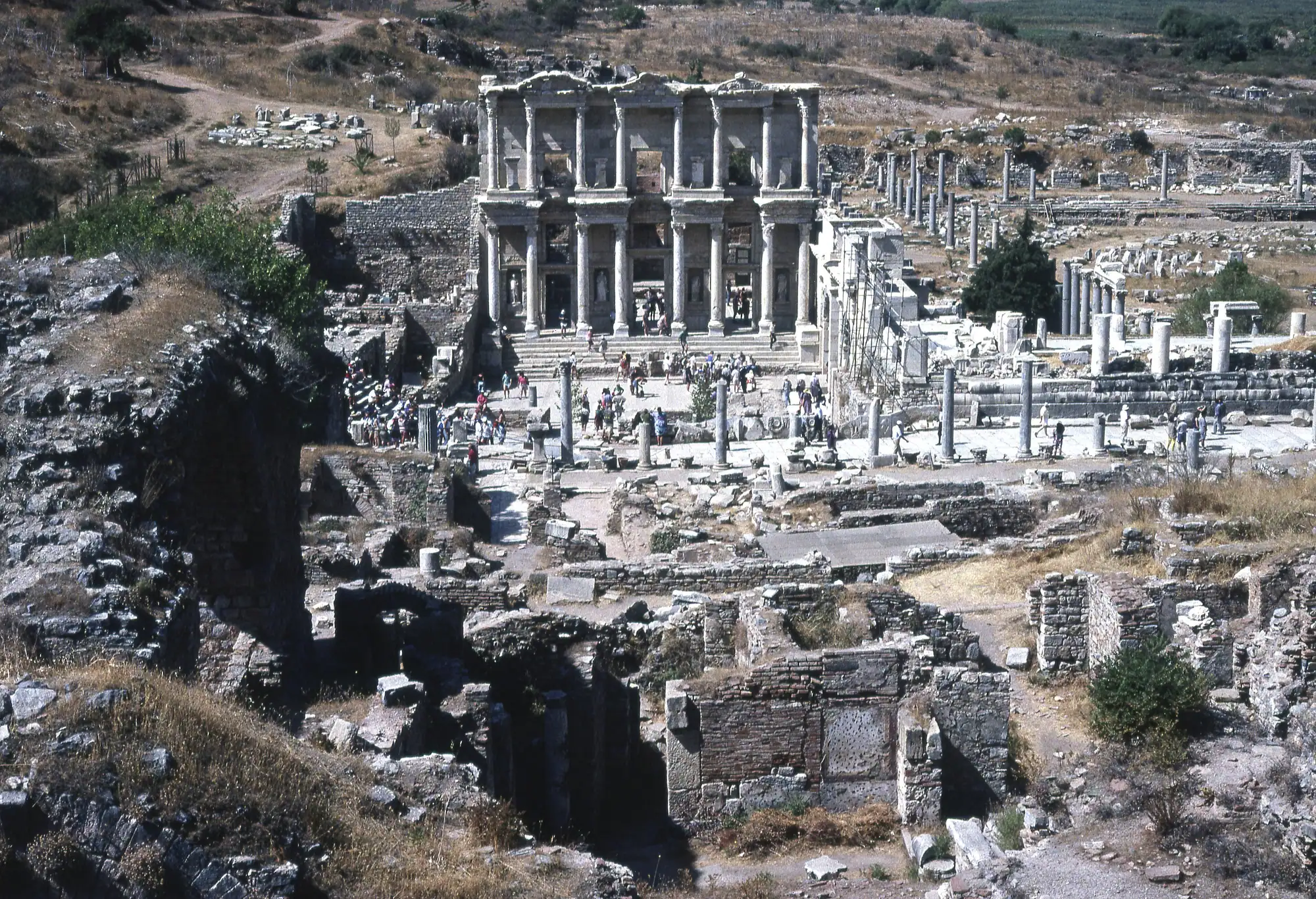
The Library of Celsus
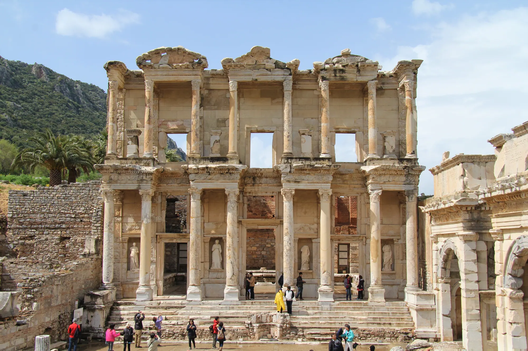
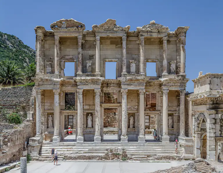
At the foot of Curetes Street the view is closed by the two-storey façade of the Library of Celsus, 21 m wide and just over 16 m high97. It honoured Tiberius Julius Celsus Polemaeanus98, a senator who had been consul in AD 9299, and it is also his tomb: he lies in a marble sarcophagus in a vaulted chamber under the apse, an honour normally kept for heroes and founders100. His son Aquila built it as his father’s memorial101, probably in the 110s and 120s, since no completion date is securely attested102.
The front uses optical corrections to look wider than it is103. It has never been moved. The façade stands on its original foundations, and in 1970–78 it was put back up there from its own fallen blocks104105.
The Gate of Mazaeus and Mithridates
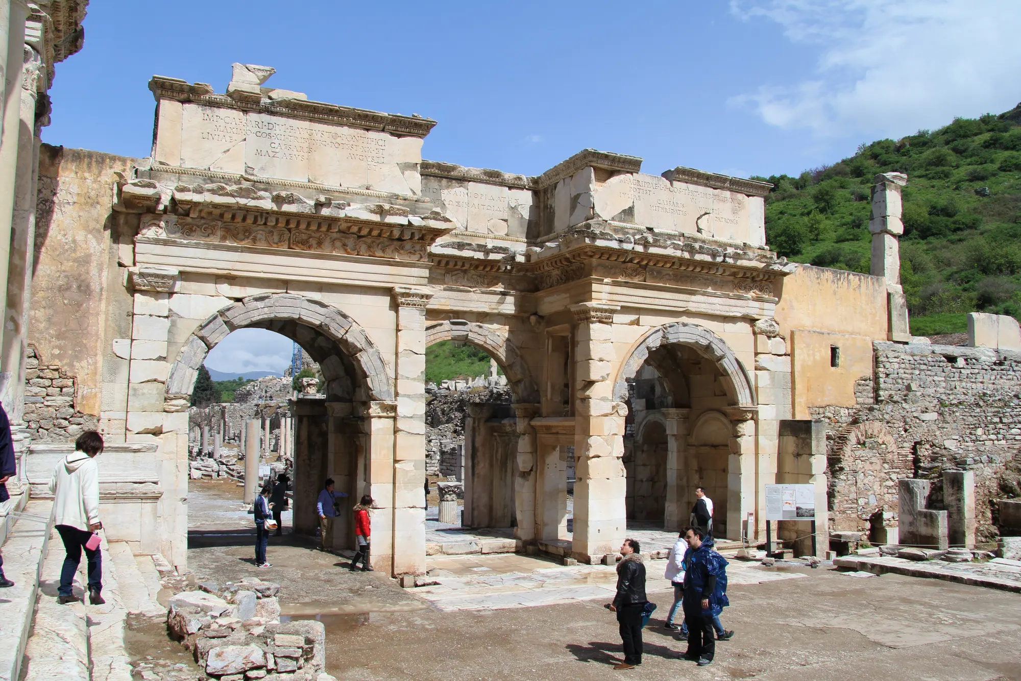
The triple gate beside the library, at the south-east corner of the Commercial Agora, was built in 4/3 BC106. Its builders, Mazaeus and Mithridates, were freedmen: former slaves of Augustus and of Agrippa respectively107. The Latin inscription honours Augustus, Livia, Agrippa and Julia as their patrons108, and the date comes from Augustus’s titles in it, his 12th consulship and 20th year of tribunician power109. The inscriptions were in Latin over the side passages and Greek over the centre, originally in gilded bronze letters110. The gate was re-erected in 1980–89, largely from its own stones, by the architect who had rebuilt the library, with the same patron paying111.
The Commercial Agora
Through the gate lies the Tetragonos Agora, the city’s great market square. It was laid out in the 3rd century BC over an 8th-century BC village and its cemetery, enlarged in the early Imperial period, heavily restored in the late 4th century AD and reorganised for the last time in the 6th112. It is roughly square, about 111 m a side, with three gates and around a hundred shops, workshops and storerooms behind its colonnades113.

Marble Street and the carved “advertisement”
Marble Street, named for its paving, links the library square with the theatre5. A Greek verse inscription found beside it honours Eutropios, probably a governor of Asia, for paving the city’s streets; a 5th-century marble bust in Vienna is conventionally identified as his portrait, likely but not certainly114.
Guides like to stop at a slab carved with a foot, a woman’s head and a heart-like shape, and call it the first advertisement in history, pointing the way to the brothel. That reading has no support, and what the carving actually means is uncertain115116. Since the “brothel” was a private house, the story fails twice over.

The Great Theatre
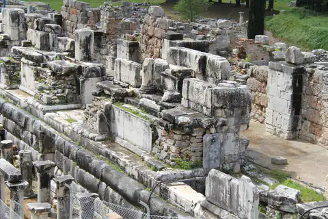
The Great Theatre stands where Marble Street ends5. Construction probably started in the second quarter of the 2nd century BC, according to the excavators’ final publication, rather than in Lysimachus’s time, where popular accounts tend to put it117. An inscription dates its three-storey marble stage building to AD 85118, and the Roman enlargements took the auditorium to almost 150 m across119.
Its capacity has shrunk in the literature: the final publication allows about 20,000, while the 24,000–25,000 of older and official sources still circulates120. The theatre fell out of use around the start of the 7th century121.
Acts 19 sets a riot here, stirred up by Demetrius, a maker of silver Artemis shrines, whose fellow craftsmen feared for their trade; for some two hours the crowd in the theatre chanted for Artemis of the Ephesians until the town clerk sent them home122. The theatre in that account is identified with this one123, and the text has St Paul held back from going in124.

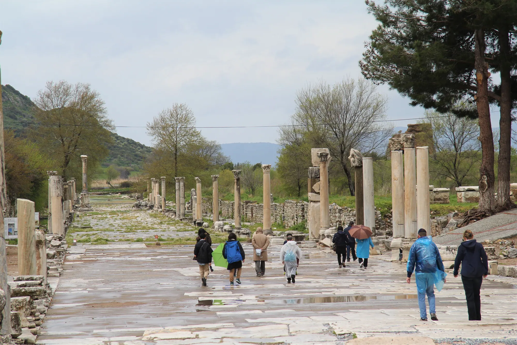
Harbour Street, the Arkadiane
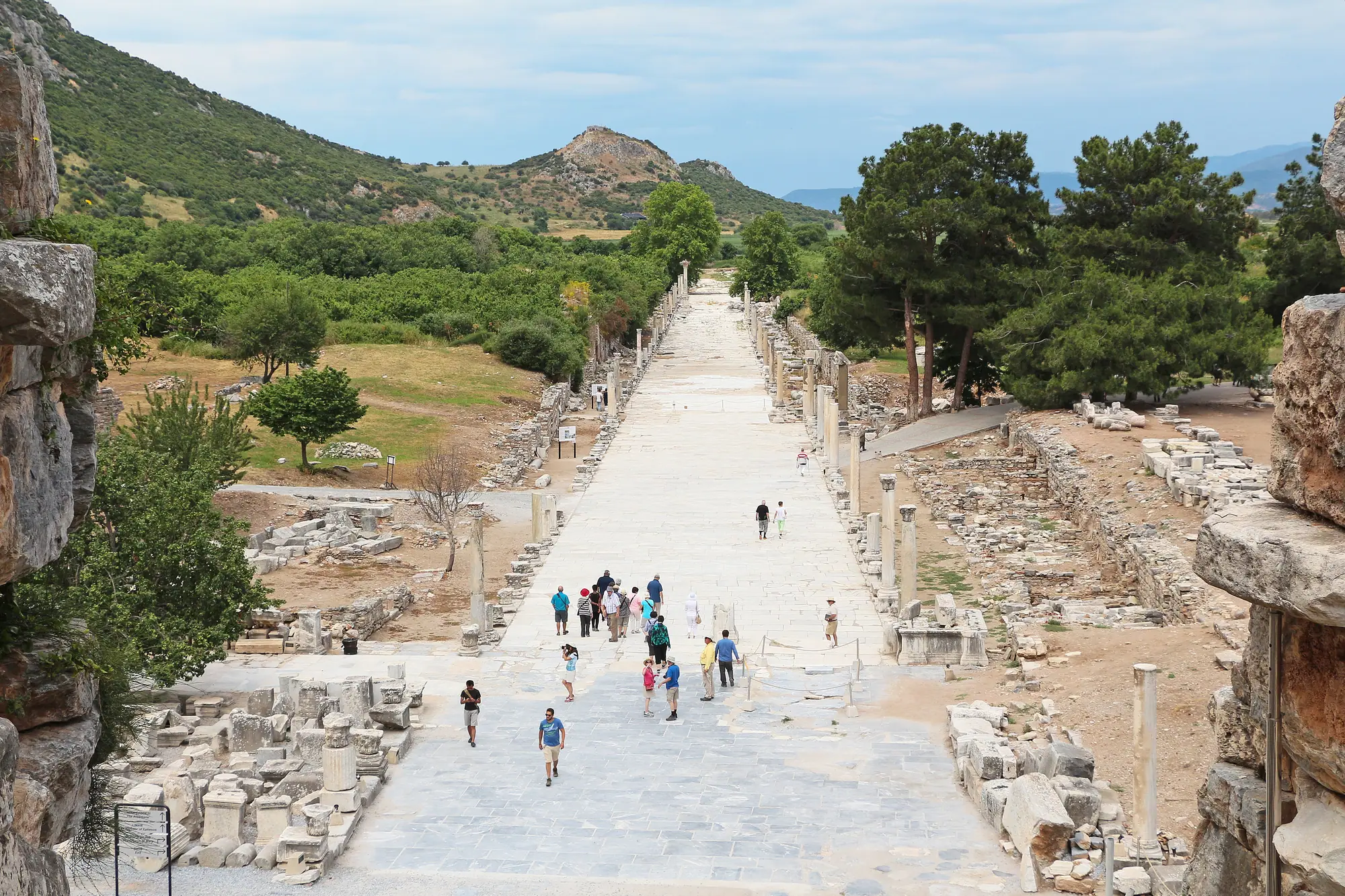
From the theatre a straight colonnaded street runs west towards the old harbour. It is named after Emperor Arcadius, who reigned 395–408, rebuilt it and raised its level6. Sources give its length as anything from just over 500 m to 570 m; the roadway was about 11 m wide, with a portico about 5 m deep along each side125. Inscriptions of late antiquity show it too was lit with lamps54.
It ended at the Middle Harbour Gate, one of three harbour gates built around the turn of the 1st and 2nd centuries AD; the South Gate had five passages, the Middle and North gates three each126.
The Harbour Baths and the Theatre Gymnasium
Ephesus had four large Roman bath-gymnasia127. The Harbour Baths, probably begun under Domitian, are the biggest of the bath complexes that can be seen at Ephesus today128. They were repaired in the 4th century; the popular name “Baths of Constantine” and its attribution to a particular emperor are not reliable129. Beside them, the Halls of Verulanus formed an exercise court of about 200 by 240 m, named after Claudius Verulanus, high priest of Asia, who paid for its marble cladding under Hadrian130. The Theatre Gymnasium stands on Harbour Street near the theatre and is only partly excavated131.

The Church of Mary
The long ruin of the Church of Mary was fitted into the southern hall of a precinct for Zeus Olympios and Hadrian, a hall about 263 m long and 30 m wide132. It has an octagonal marble-clad baptistery on its west side133.
Two church councils met in Christian Ephesus: the Third Ecumenical Council in 431 and a second in 449134. The council of 431 opened on 22 June under Cyril of Alexandria135, and tradition places it in this church. Both the venue and the date are argued over: recent excavation suggests the hall was adapted for the council, and a dedication to Mary before about 500 looks impossible136.

The Vedius Gymnasium
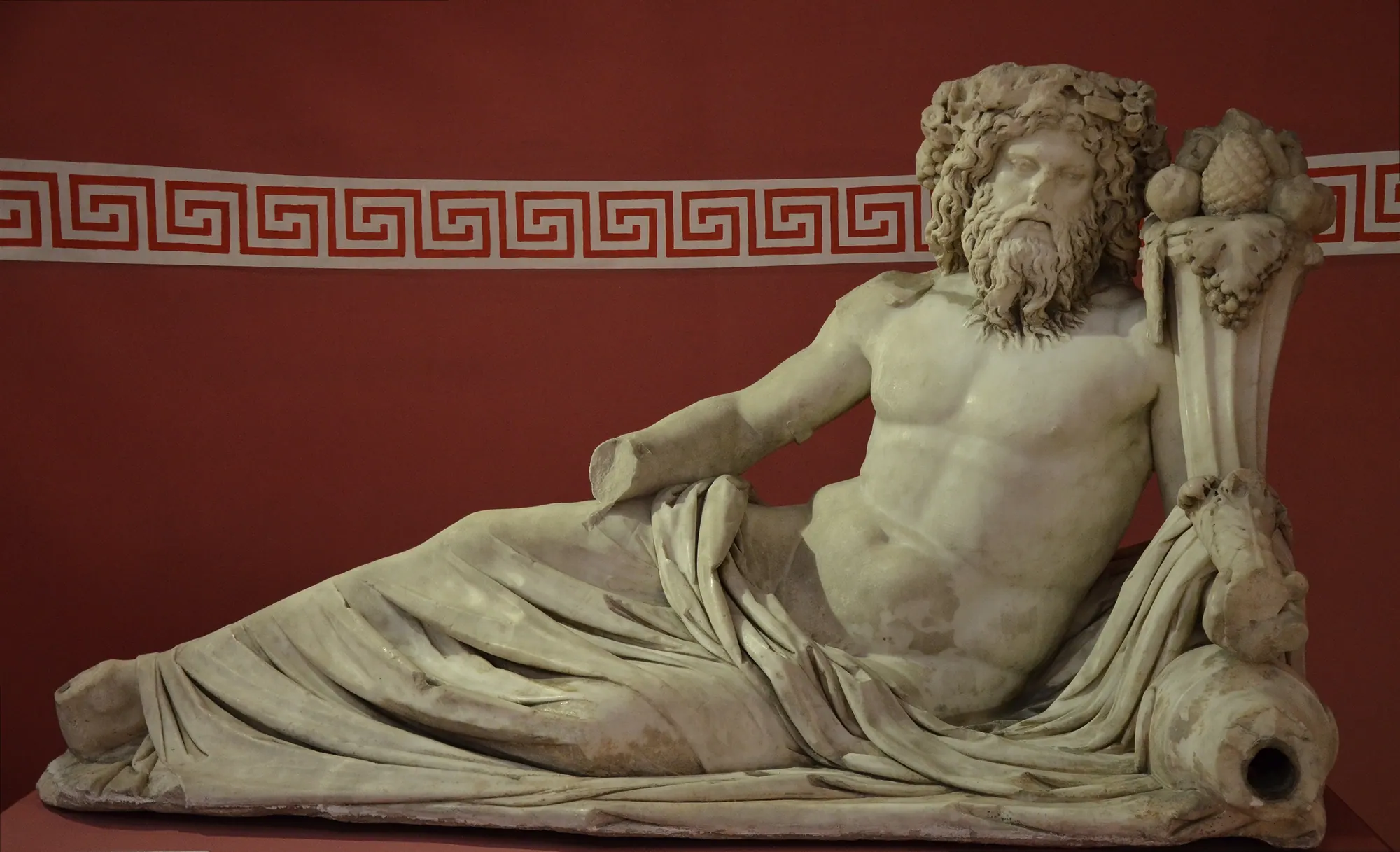
The Vedius Gymnasium was a bath-gymnasium of almost 13,000 m², opened between AD 147 and 149 and paid for by Marcus Claudius Publius Vedius Antoninus Phaedrus Sabinianus127. Whether it was dedicated to Artemis or to Aphrodite, together with Antoninus Pius, is disputed in the sources137. The statue of the river god Kaystros from its cold bath is in the İzmir Archaeology Museum138.
The Stadium
The stadium below Panayırdağ was rebuilt under Nero at the expense of Gaius Stertinius Orpex, his wife and his daughter139. In the late Roman period its curved eastern end, about 50 by 42 m, was closed off as an arena for gladiators and wild-beast shows140. Its seating was later carried off for building stone, some of it for the Basilica of St John, and a church rose over part of it in the 5th century141.

The gladiator cemetery
Outside the walls, about 300 m east of the stadium, a survey for the processional way found a gladiators’ cemetery in 1993, with tomb reliefs of gladiators dating to around AD 200142. The excavated area was only about 20 m², but it held a bone layer 3 m deep with at least 68 individuals, nearly all men aged 20 to 30143. Healed skull wounds show many had received medical care, and trident injuries match what the reliefs show144. Chemical analysis found they ate the same basic grain-and-legume diet as other Ephesians but with far more strontium, consistent with the plant-ash tonic Pliny the Elder describes145.
“St Paul’s Prison”
On a hill near the old harbour stands a well-preserved tower of the Hellenistic city wall, with internal partitions and a second storey146. The name St Paul’s Prison is attached to it by popular tradition alone; Acts mentions no prison at Ephesus, and no ancient text or find ties Paul to the tower147. Whether he was ever imprisoned in the city is a separate question, and scholars still argue it148.
The Grotto of St Paul
A small cave on the hillside of Bülbüldağ, just south of the city, served as a church from late antiquity until the 19th century149. In 1998 Renate Pillinger of the University of Vienna found paintings under the later whitewash, among them a scene of Paul teaching Thecla, who listens at a window while her mother Theocleia watches, each figure named in painted Greek150. Restoration of the paintings took from 2000 to 2010151.

The Cave of the Seven Sleepers
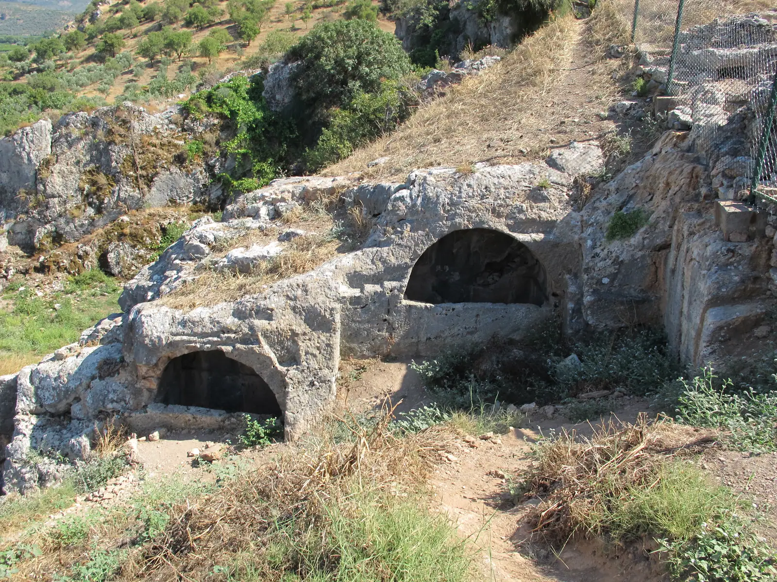
On the eastern slope of Panayırdağ lies a late antique cemetery and cave church associated with the Seven Sleepers, excavated by the Austrian team in the late 1920s152. The legend tells of young Christians walled into a cave under Decius who woke under Theodosius II, and the Qur’an tells a version of the story in Sura 18153. The excavators counted hundreds of burials from the 5th and 6th centuries, inscriptions calling on the Sleepers, and a great heap of clay lamps154. Ephesus is not the only claimant: Muslim tradition mostly places the cave at Tarsus or Afşin, and other candidates include al-Raqim near Amman, Damascus and Nakhchivan155.
Aqueducts and water power

Population
The size of Roman Ephesus is disputed. Recent density models put it at roughly 34,000 to 72,000 people; the traditional figure, still found in older books, is 200,000 to 250,000157. Strabo, writing under Augustus or Tiberius, called Ephesus the largest trading centre in Asia on this side of the Taurus and said it was growing daily158.
Decline and abandonment
The end took about a thousand years. In the mid-3rd century, under Gallienus, an earthquake and Gothic raiders arriving by sea wrecked much of the city, and the excavators place the fall of the Terrace Houses in the third quarter of that century159. Constantine, Constantius II and Arcadius rebuilt and embellished it160. Around 614–616 large parts were probably destroyed again, and the wall built afterwards took in less than half of the ancient city161.
In the 7th and 8th centuries earthquakes, Arab raids and economic change broke Ephesus into smaller centres: the old city near the harbour, a fortified Ayasuluk hill and the coast at Anaia162. The lower city was not empty even then. South of the Church of Mary, excavation shows houses occupied until the 12th century, fields after that, and a final flicker of activity in the 14th163. By the 15th century the ancient city was completely abandoned164; Ayasuluk hill, one of the centres it had split into, belongs to the landscape around Ephesus.

Excavation history
The British railway engineer John Turtle Wood came first, searching for the Temple of Artemis for the British Museum from 1863; on the way he partly uncovered the Bouleuterion and the Great Theatre165. Otto Benndorf of the University of Vienna proposed an Austrian excavation in 1893, work began in 1895, and he founded the Austrian Archaeological Institute in 189812. Fieldwork stopped for the two world wars, resumed in 1926 and restarted with annual campaigns under Franz Miltner in 1956166. The Turkish government halted the Austrian excavation in October 2016 and let it resume in May 2018167.
- early 3rd century BCLysimachus refounds the city between Pion and Preon3
- c. 100 BCThe Magnesian Gate is built27
- 4/3 BCGate of Mazaeus and Mithridates106
- AD 11Basilike Stoa dedicated on the State Agora30
- AD 85Three-storey stage building of the theatre118
- AD 89/90Temple of the Sebastoi dedicated42
- AD 147–149Vedius Gymnasium opens127
- 3rd quarter of the 3rd centuryEarthquake destroys the Terrace Houses77
- 395–408Arcadius rebuilds Harbour Street6
- 431Third Ecumenical Council meets at Ephesus134
- 15th centuryThe ancient city is completely abandoned164
- 1895Austrian excavations begin12
- 2015UNESCO World Heritage listing11

In this section
Library of Celsus
Who built the Library of Celsus, why a senator is buried under it, how its façade tricks the eye, where its statues went and how it was rebuilt in 1970–78.
Great Theatre
When the Great Theatre of Ephesus was really built, how many people it held, what Acts 19 says happened there, and how it led Wood to the Artemision.

Terrace Houses
Terrace House 2 at Ephesus: seven Roman homes under one roof, who lived in unit 6, the paintings, mosaics and graffiti, and why it needs its own ticket.
Temple of Hadrian
Who built the Temple of Hadrian at Ephesus, when and for whom, why scholars doubt it was Hadrian's temple, and what the later frieze in its porch shows.


Sources
Each source is listed once. The numbers link back to the claims it supports; dates show when the source was checked.
- kvmgm.ktb.gov.tr › gecici-sureyle-kapali-olan-muzeler-ve-bagli-birimler.html 1
- muze.gov.tr › muze-detay 1, 10
- www.turkishmuseums.com › 4 1
- Kraft, Brückner, Kayan, Engelmann 2007, Geoarchaeology 22:121-149, doi:10.1002/gea.20151 2, 3, 7, 8, 13, 15, 16, 17, 18, 19, 20, 22, 158
- Stock, Pint, Horejs, Ladstätter, Brückner 2013, Quaternary International 312:57-69 2, 3, 13, 15, 19, 20
- web.archive.org › Ephesus 2, 3, 14, 34, 159, 164
- web.archive.org › prehellenistic-ephesos.html 2, 3, 15
- Strabo 14.1, Loeb tr. 2, 7, 16, 17, 18, 158
- austriaca.at › 0xc1aa5576_0x001c9934.pdf 2, 3, 14, 15, 19, 20, 159, 162, 163
- www.oeaw.ac.at › ephesos-pre-hellenistic-settlement-history 2, 15
- www.theoi.com › Pausanias1A.html 2
- www.britannica.com › Ephesus 3, 14
- www.livius.org › ephesus 3, 12, 134
- de.wikipedia.org › Ephesos 3, 8, 11, 60, 124, 131, 157, 159, 161
- en.wikipedia.org › Arsinoe_II 3
- en.wikipedia.org › Ephesus 3, 6, 11, 12, 14, 17, 21, 32, 33, 34, 43, 47, 50, 72, 73, 102, 120, 124, 134, 156, 157, 160, 161, 164, 165, 166, 167
- en.wikipedia.org › Lysimachus 3
- turkisharchaeonews.net › curetes-street-ephesus 4, 9, 23, 51, 52, 53
- de.wikipedia.org › Kuretenstraße 4, 23, 52, 53, 85, 93, 94
- www.livius.org › ephesus-marble-street 5, 115
- en.wikipedia.org › Head_of_Eutropius 5, 114
- turkisharchaeonews.net › arcadiane-harbour-street-ephesus 6, 54, 125, 126
- Macquarie Univ., The Coinage of Ephesus 7, 17, 95
- www.austriaca.at › 9783700183419 9, 92, 96
- OpenStreetMap nodes: Lower Gate 37.9454,27.3421; Upper Gate 37.9355,27.3462; Selçuk station 37.9509,27.3729 10
- turkishmuseums.com › 4 10
- web.archive.org › multiple=1 11
- web.archive.org › 1018 11, 13
- whc.unesco.org › 6387 11, 21, 25, 136
- www.oeaw.ac.at › Forschungsgeschichte_Ephesos.pdf 12, 165, 166, 167
- www.oeaw.ac.at › ephesos-bio-geo-archive 13, 162
- web.archive.org › paleography.html 14, 20
- www.hurriyetdailynews.com › ephesus-ancient-city-meets-sea-again-28358 14
- islamansiklopedisi.org.tr › ayasuluk 14
- penelope.uchicago.edu › 16*.html 19
- turkisharchaeonews.net › harbour-ephesus 21, 126
- tr.wikipedia.org › Efes 22, 33, 34, 41, 45, 51, 161
- archive.org › cu31924008628301_djvu.txt 24
- etheses.bham.ac.uk › Leger15PhD_Redacted.pdf 24
- www.cambridge.org › 7A700C9DE0BB71BAEE159CF16C370D54 24
- 19 Feb 2023 24, 28
- en.wikipedia.org › John_Turtle_Wood 24, 28
- www.worldheritagesite.org › ephesus 25
- OSRM car/foot profiles over OpenStreetMap, our query 2026-09-14 26
- web.archive.org › magnesian-gate.html 27
- turkisharchaeonews.net › magnesian-gate-area-ephesus 27
- de.wikipedia.org › John_Turtle_Wood 28
- www.austriaca.at › 0xc1aa5576_0x00185c50.pdf 29, 30, 31, 46, 126, 131
- turkisharchaeonews.net › state-agora-ephesus 29, 30, 31, 48
- doi.org › hist.2020.848 30, 31, 42, 45, 57
- api.europeana.eu › search.json 30
- www.europeana.eu › item_WYVCDNBVHZXBUAPKZWQVEEGZMPXXR7KU 30
- turkisharchaeonews.net › domitian-square-ephesus 30, 43, 47, 48
- turkisharchaeonews.net › public-buildings-north-state-agora-ephesus 31, 33, 35, 36, 41, 62
- penelope.uchicago.edu › 51*.html 32
- en.wikipedia.org › Asia_(Roman_province) 32
- doi.org › 0x00252f10 34
- de.wikipedia.org › Prytaneion_von_Ephesos 35, 36, 37, 41, 53, 62
- austriaca.at › 0xc1aa5576_0x0022b560.pdf 37, 38, 39, 40
- www.austriaca.at › 0xc1aa5576_0x001c9936.pdf 37
- turkisharchaeonews.net › ephesus-museum-selçuk 38, 39, 40
- de.wikipedia.org › Ephesos-Museum_Selçuk 38, 39, 40, 41, 45, 48, 58, 73, 95
- tr.wikipedia.org › Efes_Müzesi 40
- en.wikipedia.org › Temple_of_the_Sebastoi 42, 44
- turkisharchaeonews.net › trajans-nymphaeum-ephesus 44, 56, 57, 58, 59, 96
- www.livius.org › ephesus-temple-of-domitian-statue-of-titus 45
- turkisharchaeonews.net › hydreion-and-memmius-monument-ephesus 46, 49
- www.oeaw.ac.at › forschungen-in-ephesos 49, 56, 75
- en.wikipedia.org › Gaius_Memmius_(consul_34_BC) 49
- Appian, Mithridatic Wars 21-23 50
- www.bestephesustours.com › harbour-street-arcadiane-in-ephesus.html 54
- www.cambridge.org › ceremonial_armatures_porticated_streets_and_their_architectu 54
- api.crossref.org › 1874-6772_seg_a49_1486 54
- www.oeaw.ac.at › research-history 55, 74, 81, 105
- de.wikipedia.org › Hadrianstempel_(Ephesos) 55, 60, 67, 68, 69, 70, 71, 72, 73
- www.livius.org › ephesus-fountain-of-trajan 57
- www.gutenberg.org › pg2811.txt 59
- www.thelatinlibrary.com › pliny.ep6.html 59
- turkisharchaeonews.net › scholastica-baths-ephesus 60, 61, 68
- austriaca.at › 0xc1aa5576_0x0007e384.pdf 61
- journals.uio.no › 5874 61
- www.austriaca.at › 0xc1aa5576 0x00043046.pdf 63, 64, 65, 66
- turkisharchaeonews.net › public-latrines-ephesus 63
- www.theephesus.com › brothel-of-ephesus 64, 65, 66, 115
- www.turkishmuseums.com › 1 67, 69, 70
- turkisharchaeonews.net › temple-hadrian-ephesus 67, 70, 71, 72, 73
- www.quatember.at › project1.html 68
- www.petersommer.com › ephesus-terrace-house-2 74, 75, 76, 77, 78, 79, 80
- de.wikipedia.org › Hanghäuser_von_Ephesos 74, 75, 77, 78, 81
- austriaca.at › 0xc1aa5576_0x002507fb.pdf 76
- turkisharchaeonews.net › terrace-houses-ephesus 76, 80
- www.oeaw.ac.at › preserving-world-cultural-heritage-austrian-researchers-star 77, 97, 103, 104
- verlag.oeaw.ac.at › 600858 79
- doi.org › 0x0003f0d7 80
- oajournals.fupress.net › 10981 80
- austriaca.at › 0xc1aa5576_0x003ad2db.pdf 80
- www.ephesustoursbylocals.com › entrance-fees 82
- dosim.ktb.gov.tr › 132665,kambine-biletpdf.pdf 82
- pmc.ncbi.nlm.nih.gov › PMC11723936 83, 84, 88, 89, 90, 91
- www.oeaw.ac.at › cleopatras-sister-remains-missing-1 83, 84, 85, 86, 88, 89, 90, 91
- turkisharchaeonews.net › octagon-ephesus 83, 84, 85, 86, 87, 92
- en.wikipedia.org › Arsinoe_IV 85, 86, 87
- turkisharchaeonews.net › hellenistic-heroon-ephesus 93, 94, 96
- freidok.uni-freiburg.de › Hueber_Strocka_Die_Bibliothek_des_Celsus.pdf 97, 98, 99, 100, 101, 103, 104, 105, 111
- de.wikipedia.org › Celsus-Bibliothek 97, 98, 100, 101, 102, 105
- en.wikipedia.org › Tiberius_Julius_Celsus_Polemaeanus 98, 99
- www.livius.org › ephesus-library-of-celsus 99, 100
- en.wikipedia.org › Library_of_Celsus 100
- www.khm.at › celsusbibliothek-segmentgiebel-50740 102
- www.khm.at › episteme-kelsou-51932 102
- turkisharchaeonews.net › library-celsus-ephesus 102
- www.worldhistory.org › Library_of_Celsus 102
- de.wikipedia.org › Friedmund_Hueber 105, 111
- www.livius.org › ephesus-gate-of-mazaeus-and-mithridates-inscription-1 106, 107, 108, 109, 110
- turkisharchaeonews.net › gate-mazaeus-and-mithridates-ephesus 106, 107, 108, 110, 111
- www.livius.org › ephesus-gate-of-mazaeus-and-mithridates-inscription-3 107
- www.livius.org › ephesus-marble-street-inscription-of-mithradates 107
- en.wikipedia.org › Marcus_Vipsanius_Agrippa 109
- austriaca.at › 3632-3 112
- turkisharchaeonews.net › commercial-agora-ephesus 112, 113
- www.tumblr.com › tetragonos-agora-commercial-agora-ephesus 113
- www.khm.at › eutropios-51931 114
- laststatues.classics.ox.ac.uk › detail.php 114
- laststatues.classics.ox.ac.uk › detail.php 114
- api.openalex.org 116
- www.aa.com.tr › 2333476 117, 120
- austriaca.at › 7590-2 117, 118, 120
- www.worldhistory.org › ephesos 117
- turkisharchaeonews.net › great-theatre-ephesus 118, 119, 120, 121
- www.archaeologie-online.de › baugeschichte-des-theaters-von-ephesos-rekonstruiert-5399 119, 120, 121
- austriaca.at › 8268-9 119
- web.archive.org › theater.html 120
- bible-api.com › acts+19 122, 147
- www.newadvent.org › act019.htm 122
- www.newadvent.org › 05490a.htm 123, 133
- en.wikipedia.org › Acts_19 123
- www.biblegateway.com › passage 124
- www.hurriyetdailynews.com › restoration-to-revive-roman-bath-complex-in-ephesus-204032 125, 128
- austriaca.at › 3950-8 127
- turkisharchaeonews.net › vedius-gymnasium-ephesus 127, 137, 138
- de.wikipedia.org › Vediusgymnasium 127, 131
- turkisharchaeonews.net › hall-verulanus-and-harbour-baths-ephesus 128, 129, 130
- www.bestephesustours.com › the-verulanus-sports-arena-in-ephesus.html 130
- www.cambridge.org › 988373D4ACA691E1D027C304C3E87088 132
- de.wikipedia.org › Marienkirche_(Ephesos) 132, 133, 136, 148
- it.wikipedia.org › Efeso 134, 160
- www.newadvent.org › 05491a.htm 135
- en.wikipedia.org › Council_of_Ephesus 135, 136
- www.academia.edu › Ephesus_the_Stadium_2008_Encyclopedia_of_the_Hellenic_World_ 139
- turkisharchaeonews.net › stadium-ephesus 139, 140, 141
- www.bestephesustours.com › the-stadium-of-ephesus.html 140
- os.pennds.org › 2006_160_2-3_KanzGrossschmidt.pdf 142, 143, 144
- journals.plos.org › article 142, 145
- pubmed.ncbi.nlm.nih.gov › 16289900 143, 144
- www.trtworld.com › 12775911 145
- www.bestephesustours.com › the-city-walls-of-ephesus-magnesia-gate.html 146
- www.viaurbis.com › the-hellenistic-city-wall 146
- etsjets.org › files_JETS-PDFs_61_61-3_JETS_61.3_549-558_White.pdf 147, 148
- www.bibleplaces.com › the-grotto-of-saint-paul-in-ephesus 149, 150, 151
- holylandphotos.wordpress.com › the-cave-grotto-of-paul-and-thecla-at-ephesus 149
- www.archaeologie-online.de › apostel-paulus-unter-tuenche-760 150, 151
- web.archive.org › paulusgrotte.html 151
- www.kulturportali.gov.tr › yedi-uyuyanlar-magarasi 152, 154, 155
- turkisharchaeonews.net › grotto-seven-sleepers-ephesus 152, 153, 154
- en.wikipedia.org › Seven_Sleepers 152, 153, 154, 155
- api.alquran.cloud › en.sahih 153
- doi.org › cbo9780511599491.003 153
- doi.org › ejoss_v03i1004 153
- digitalwindow.vassar.edu › 3 153
- web.archive.org › pdf 156
- web.archive.org › water-supply.html 156
- exarc.net › 10039 156
- en.wikipedia.org › Hierapolis_sawmill 156
- web.archive.org › hanghaus-2-marmorsaal.html 159
- en.wikipedia.org › 262_Southwest_Anatolia_earthquake 159
- fr.wikipedia.org › Éphèse 159
- www.thebyzantinelegacy.com › ephesus 160, 161, 163
- www.blueguides.com › the-shifting-fortunes-of-ephesus-its-rise-and-fall-and-rise 161, 162, 163
- Ladstätter 2019, Ephesos from Late Antiquity until the Middle Ages, SoSchrÖAI 58:11-72) [abstract snippet] 162, 163, 164
- web.archive.org › mittelalterforschung.html 162, 163, 164