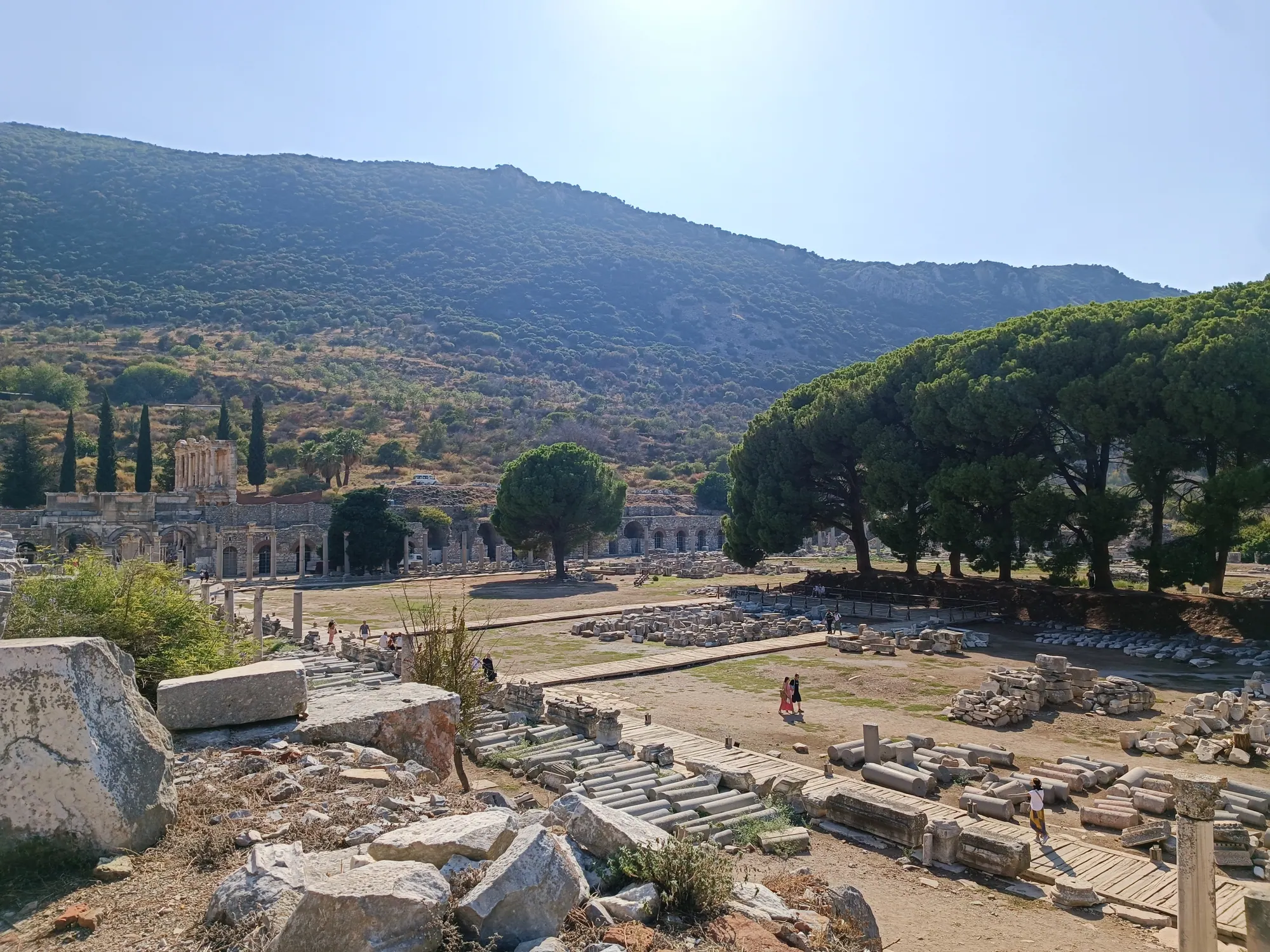
From gate to gate
The map shows the ancient street sequence. Follow current signs on the ground. Select the map to enlarge it, or a stop to read about it.
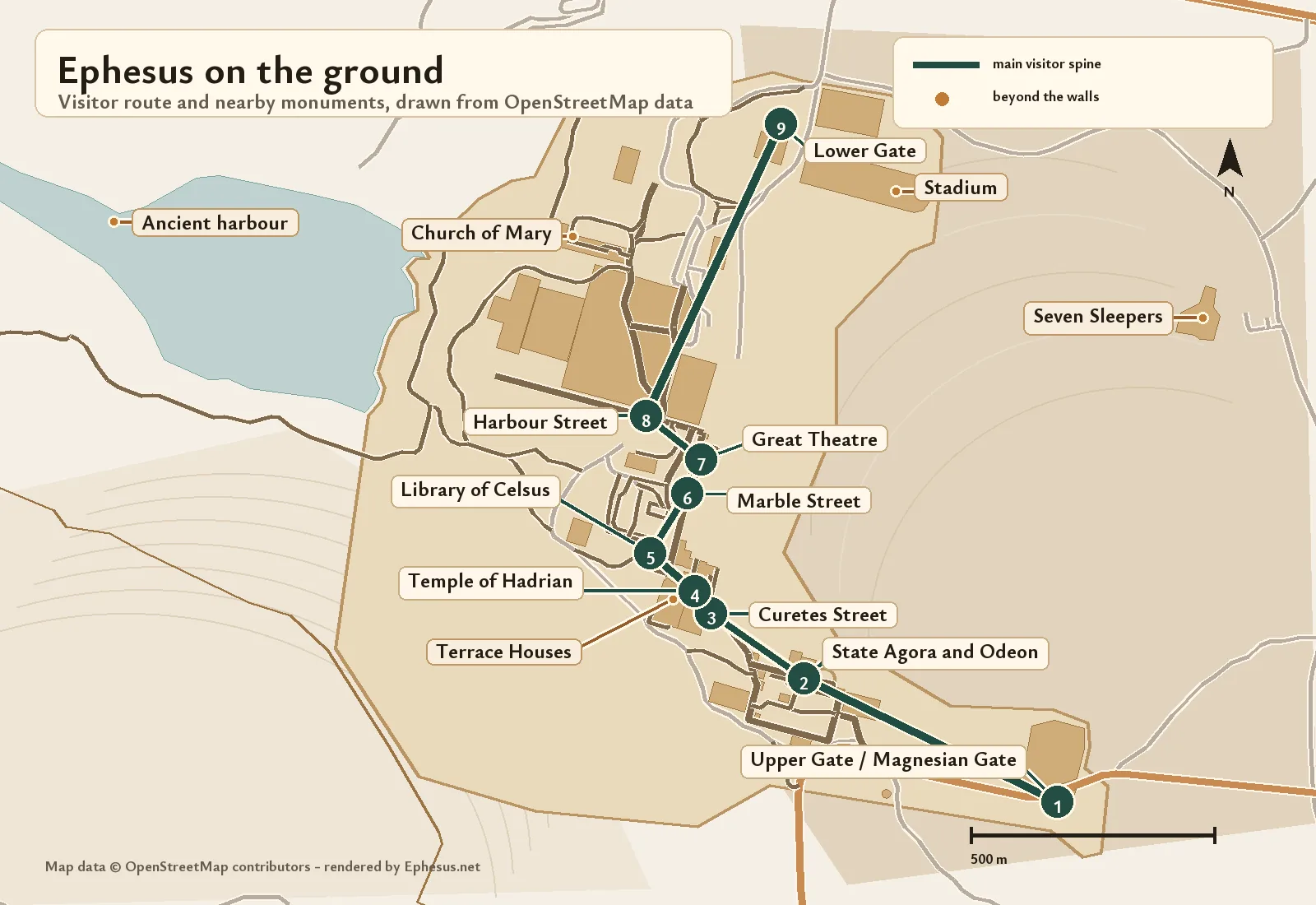
The ruins at Ephesus are not the oldest city on the spot. They belong to the new town that Lysimachus, one of Alexander the Great’s successors, laid out sometime in the early 3rd century BC2, in the low ground between Panayırdağ and Bülbüldağ3, the hills known in antiquity as Pion and Preon4. Down that valley runs a single sloping street, Curetes Street, ending at the Library of Celsus5. From the library square Marble Street leads to the theatre6, and from the theatre a colonnaded avenue heads for the old harbour7. Once that spine is clear, the rest of the site falls into place.
Layout: a grid and one diagonal
Lysimachus’s walls followed the crest of Bülbüldağ and enclosed a fortified area more than 4 km long and 2 km wide14. Inside them the streets of the Hellenistic town met at right angles on a regular plan15.
Curetes Street ignores that plan. It crosses the grid at a slant, and archaeologists read this as a sign that the route is older than the grid and served as a processional way for Artemis16. It is the one line worth fixing in mind before a visit: almost everything in the ancient city either stands on it or is reached from one of its ends.
The walled city is only one part of what UNESCO protects. The 2015 inscription drew the property as four separate components: the prehistoric mound of Çukuriçi Höyük (1.5 ha), the ancient city (614.76 ha), Ayasuluk Hill with the Artemision and the medieval town (45.82 ha), and the House of the Virgin Mary (0.55 ha)9. Together they come to 662.62 ha, surrounded by a buffer zone of 1,246.3 ha17.
Where are the entrances to Ephesus?
Ephesus has two entrances, each with a ticket office: the Lower Gate to the north, on the Selçuk side, and the Upper Gate to the south8. Fees, hours and restoration closures change often, so they are kept on the tickets and opening hours page with the date each was checked. The upper entrance often borrows the name of the Magnesian Gate8, yet the real gate, the largest in the city, is about 300 m further south on the old road to Magnesia18.
What separates the two ends on the ground is height. Curetes Street alone drops about 20 m, from around 30 m above sea level at the top to less than 10 m by the library10. Starting at the Upper Gate therefore means walking downhill for most of the route, which is worth weighing when planning a visit to Ephesus.
The upper city: from the Magnesian Gate to Domitian Square
The Magnesian Gate was long taken to be part of Lysimachus’s fortifications, one of several long-repeated errors about Ephesus. J. T. Wood uncovered it in 1869, but only the digging of 2008–09 established that it was built around 100 BC18.
State Agora. In its Roman form the square measured about 58 × 155 m, with halls on its sides19. The north side was closed by the Basilike Stoa, a hall of some 167 m with bulls’ heads carved on its Ionic capitals, which C. Sextilius Pollio and his family dedicated in AD 1120. A small temple occupied the centre. The old label “Temple of Isis” has given way to a more cautious reading as an Augustan sanctuary, possibly for the deified Julius Caesar and Roma, or for Augustus himself21.
Bouleuterion. Next to the agora sits a small theatre often called the Odeon. It was in fact the council house, put up around AD 150 by P. Vedius Antoninus and probably roofed22, with estimated seating for 1,400 to 1,50023.
Prytaneion. Here the city’s executive met and the sacred hearth of Hestia burned. At Ephesus it was kept by the Curetes, priests whose names were cut into the building’s columns24. Franz Miltner found the Prytaneion in 1955 and identified it a year later25. Marble statues of Artemis of Ephesus had been buried inside, the Colossal and the Beautiful Artemis among them; both are now in the Ephesus Museum at Selçuk26.
Temple of the Sebastoi. Once called the Temple of Domitian, it was dedicated in AD 89/90, and with it Ephesus became neokoros, official temple warden of the emperors, for the first time27. It rose on an artificial terrace held up by vaulted substructures28.
Memmius and Pollio monuments. Gaius Memmius, a grandson of the dictator Sulla, built the Memmius Monument under Augustus to honour three generations of his family29. The Pollio Monument, erected in AD 9730, commemorates the same C. Sextilius Pollio who paid for the Basilike Stoa and an aqueduct31. The Polyphemus group displayed there first stood in the pediment of the agora temple32. The Hydreion, a fountain by Domitian Square, carries an inscription dating it to AD 198–21133.

Curetes Street: the spine of the site
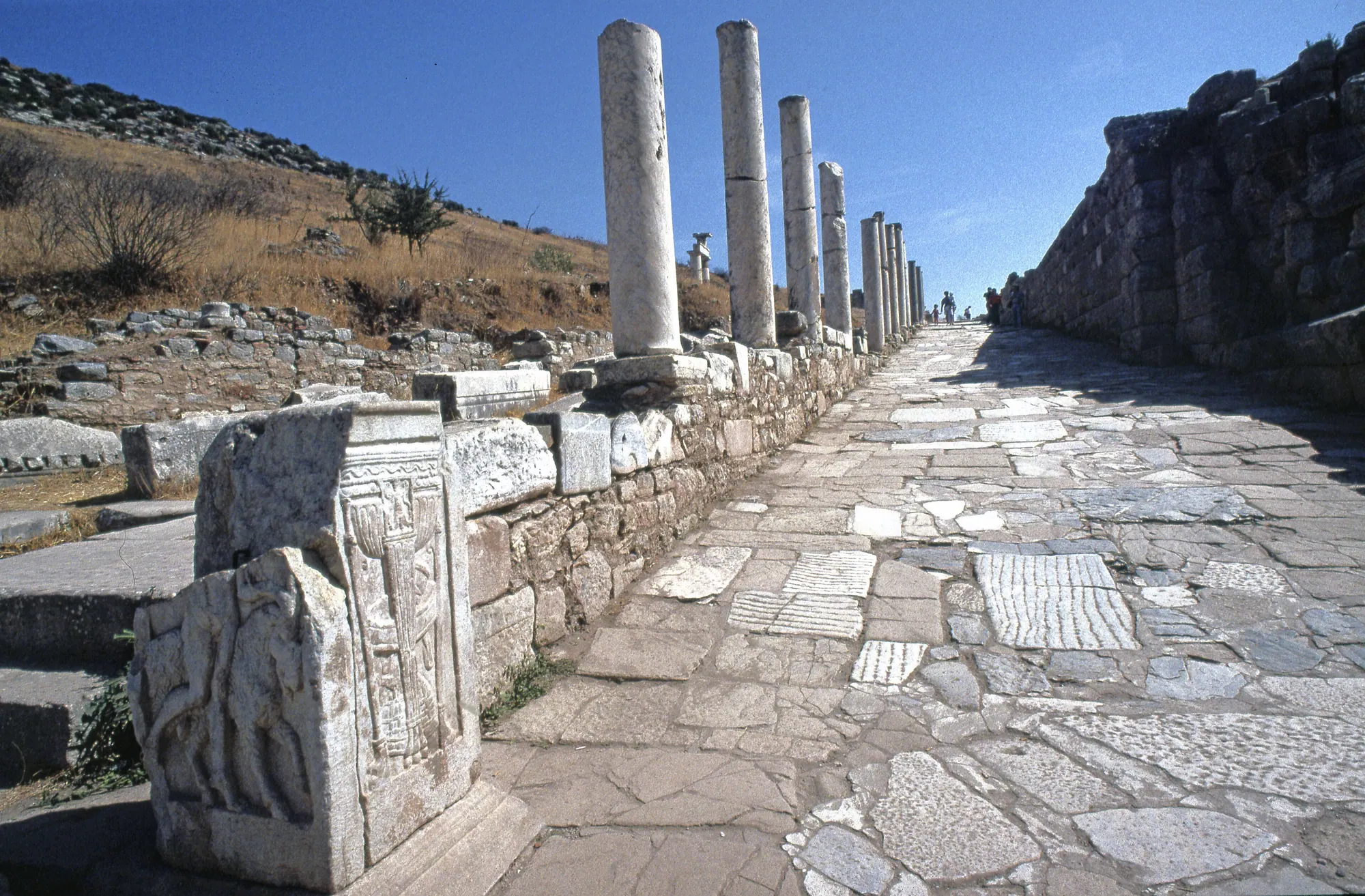
Curetes Street starts at the Hercules Gate and ends at the library5. Ephesians probably knew it as the Embolos, meaning “wedge”. The name used today was borrowed from inscribed lists of Curetes priests, carved originally for the Prytaneion and later reused as building stone along the street34. In its final phase the paving was 6–8 m wide, flanked by colonnaded halls 3.5–5 m deep, on a gradient of about 10%10.
Hercules Gate. The gate at the top dates from late antiquity. It narrowed the street and closed it to carts, and its reliefs of Hercules in his lion skin are reused 2nd-century pieces35.
Nymphaeum of Trajan. Ti. Claudius Aristion and his wife Julia Lydia Laterane dedicated the fountain to Artemis and Trajan, and funded a water conduit 210 stadia long as well36. Its stage-like front stood about 9.5 m tall behind a basin almost 12 m long; in the middle niche was a statue of Trajan around 4 m high, judging by the one foot that survives37.
Temple of Hadrian. The dedication of the Temple of Hadrian, made by Publius Quintilius Valens Varius with his wife and daughter, names Artemis, Hadrian and the Ephesian people38. Temple and bath building behind it were designed as a pair39.
Scholastica Baths and the latrine. The Varius Baths and the Scholastica Baths are the same complex. Varius built it around the turn of the 1st and 2nd centuries, and a Christian woman named Scholastica restored it in the 4th or 5th40; her seated statue, now without its head, still occupies a niche41. A 1st-century public latrine lies close to where Curetes Street meets Marble Street, its marble seats set above a flushing channel that ran round an open central pool42.
Terrace Houses. On the slope above the street, Terrace House 2 is a block of about 4,000 m²43 containing seven homes, each a peristyle house stepped over three terraces44. The Terrace Houses were roofed over for protection in 1999/200045.
Octagon and Heroon. The Octagon, an eight-sided marble tomb, was built in the late 1st century BC; its square base is all that survives where it stood46. Next to it is the so-called Heroon of Androklos, a U-shaped Hellenistic structure converted later into a fountain47.
The library square and the Commercial Agora
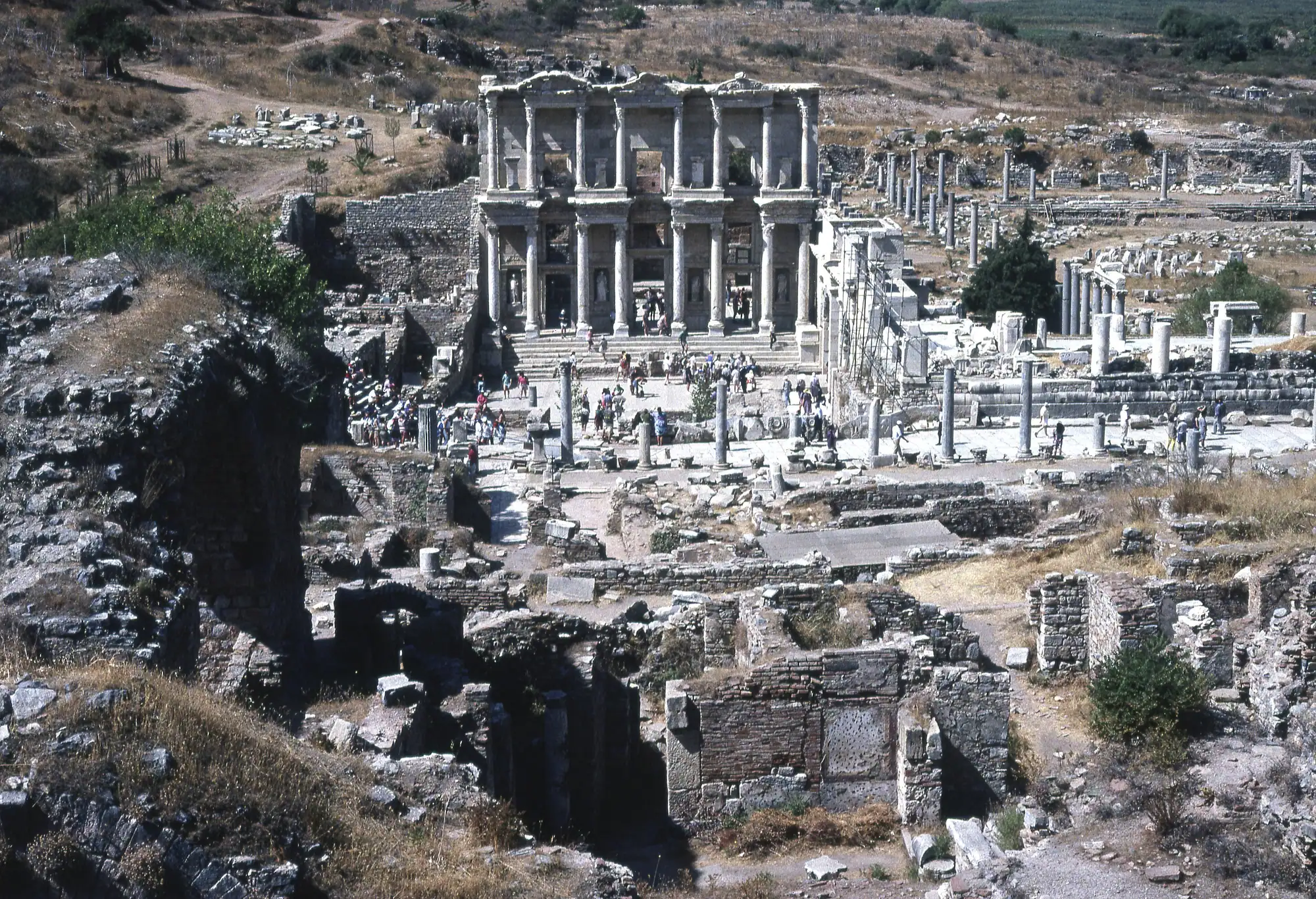
Curetes Street ends at the Library of Celsus, built as the memorial of Tiberius Julius Celsus Polemaeanus, who lies in a chamber under its apse4849. Its doors and windows open to the east50, so the façade catches the morning sun.
Right next to the library, at the corner of the Commercial Agora, stands the triple Gate of Mazaeus and Mithridates, built in 4/3 BC51. Between 1980 and 1989 it was rebuilt, mostly from its own ancient blocks52.
The Commercial or Tetragonos Agora was the city’s main market: close to square, about 111 m a side, entered by three gates and lined with around 100 shops, workshops and storerooms behind its colonnades53. Its builders set it out in the 3rd century BC on top of an 8th-century BC village and cemetery54.

The lower city: theatre, harbour and gymnasia
Great Theatre. Marble Street comes out at the Great Theatre, the theatre of the silversmiths’ riot in Acts 1955. After its Roman enlargements the auditorium was nearly 150 m across56.
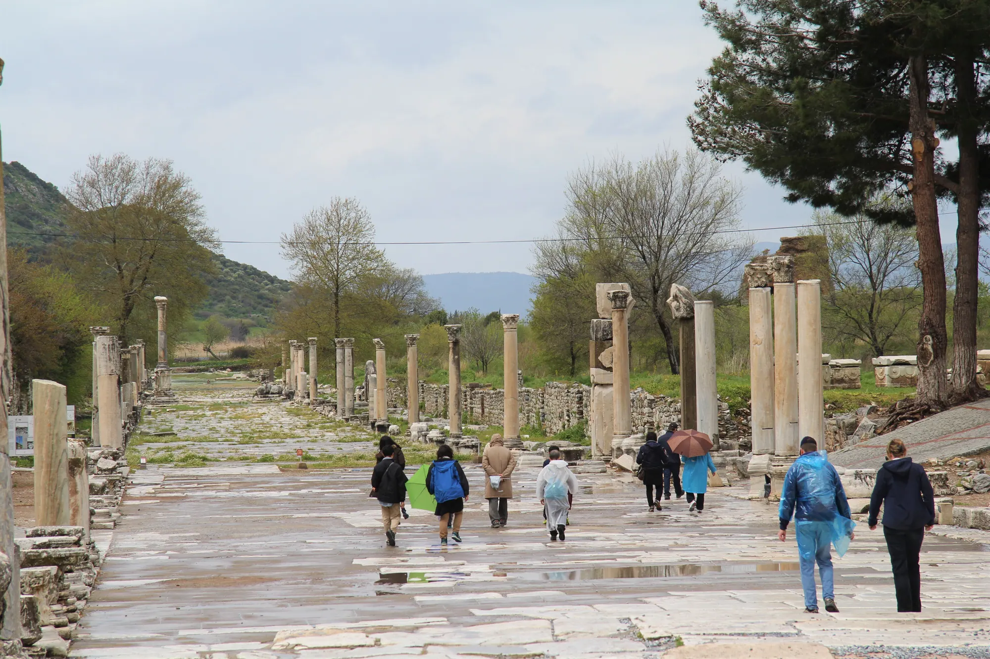
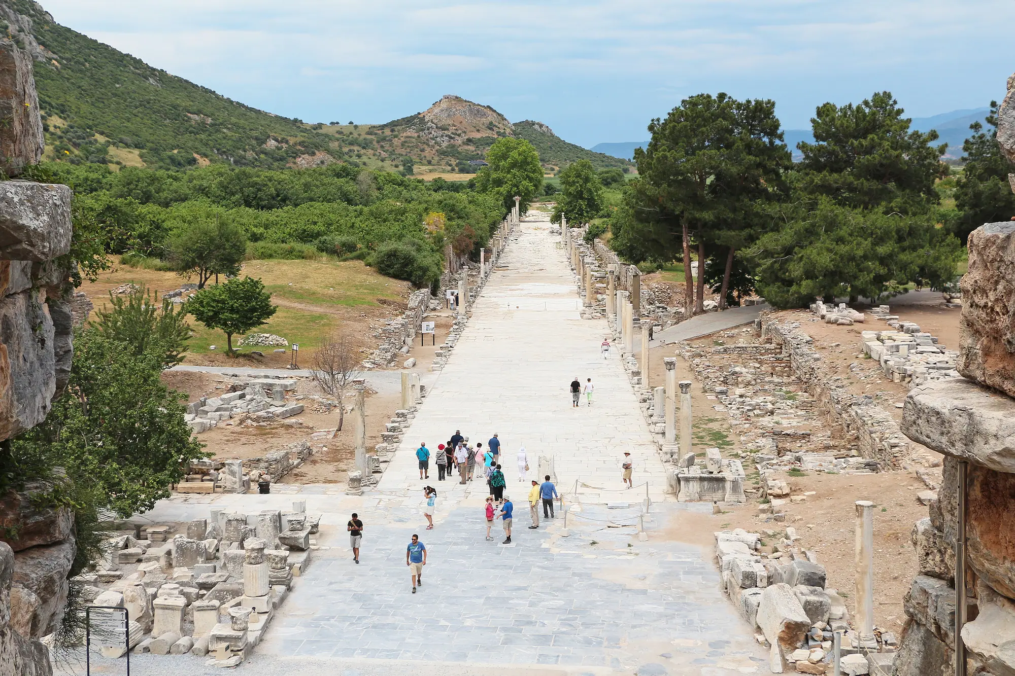
Harbour Street. The Arkadiane, the colonnaded avenue from theatre to harbour, takes its name from the emperor Arcadius (395–408), who rebuilt it7. Its length is variously put at 500 to 570 m, with a carriageway of roughly 11 m57.
The harbour. Three gates of the late 1st or early 2nd century AD led in from the quay58. The basin itself silted up long ago and is now a small marshy lake59.
Baths and gymnasia. Of all the Roman baths visible at Ephesus, the Harbour Baths are the largest, and work on them probably started under Domitian60. Beside them lay the Halls of Verulanus, an exercise court with colonnades about 200 × 240 m61. The Theatre Gymnasium, on Harbour Street by the theatre, has only been partly dug62. The Vedius Gymnasium, one of four large bath-gymnasia in the city, spread over almost 13,000 m² and opened in AD 147–14963.
Stadium. Below Panayırdağ lies the stadium, rebuilt under Nero64. Late in the Roman period its rounded east end was walled off to make an arena for gladiators and animal fights65.
Church of Mary. Among the monuments of sacred Ephesus, this church was fitted into the long south hall of the Olympieion, the harbour-side precinct of Zeus Olympios and Hadrian; the hall is about 263 × 30 m66. Tradition makes it the venue of the Council of Ephesus in 431, but that attribution and the church’s own date are both still argued over67.
“St Paul’s Prison”. A tower of the Hellenistic wall on a hill by the old harbour goes by this name68. The label is folklore: nothing in Acts or in the archaeology ties Paul’s time in Ephesus to the building69.
Beyond the walls
Several of the places that bring people to the Ephesus area are outside the ancient city, a few within walking distance, others a drive away.
Cave of the Seven Sleepers. A late-antique cemetery and cave church tied to the legend sit on the eastern slope of Panayırdağ70. Ephesus is not the only claimant: sites in Jordan, and at Tarsus and Afşin in Turkey, tell the same story71. There is no ticket office, and according to guide sources the fence gate is often locked72.
Gladiator cemetery. Discovered in 1993, it lies about 300 m east of the stadium, at the northern foot of Panayırdağ73.
Grotto of St Paul. This little cave church sits on the north slope of Bülbüldağ, south of the city74. Ordinary visitors cannot go in; a visit needs permission in advance from the museum directorate at Selçuk75.
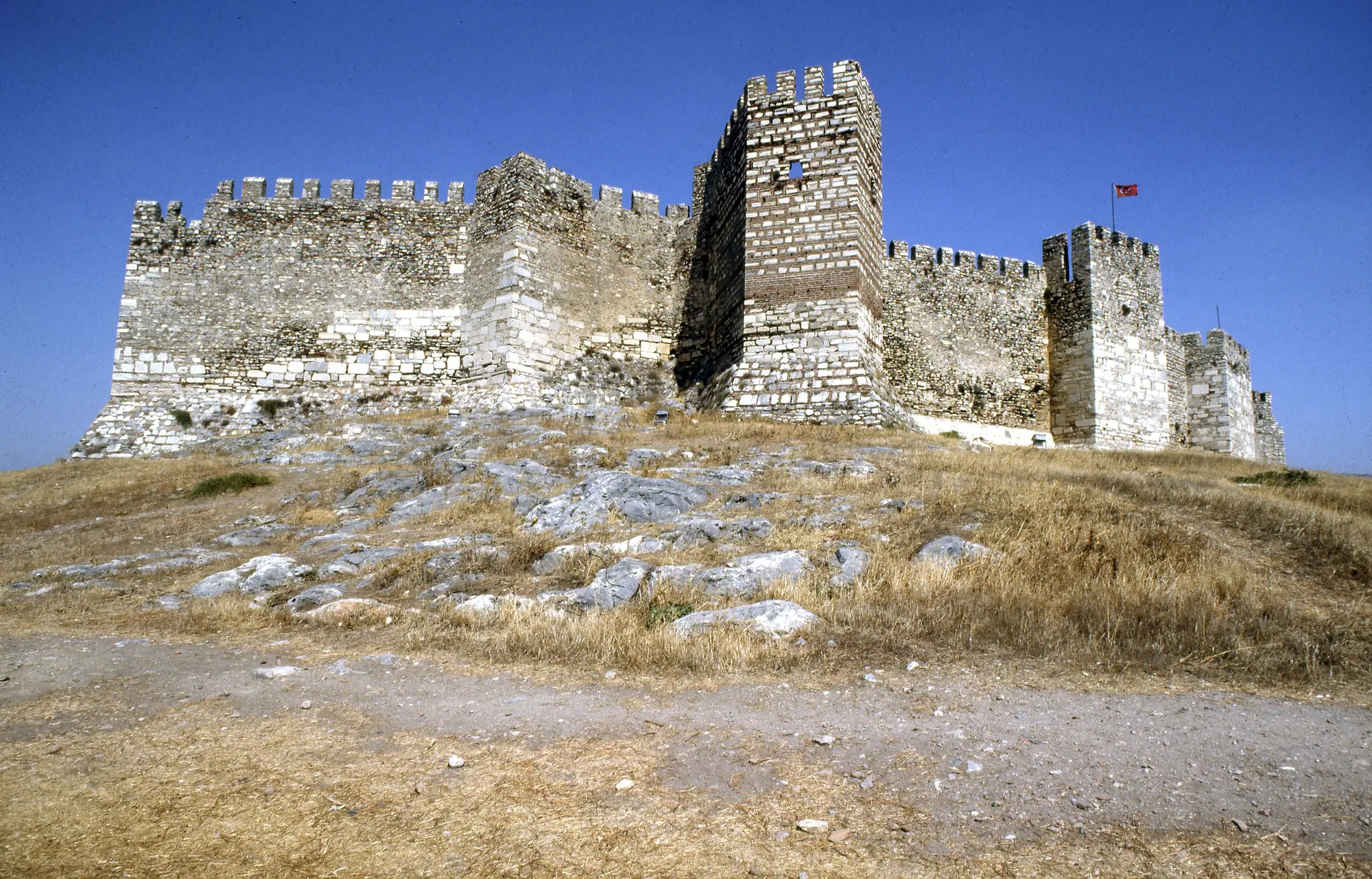
The Artemision and Ayasuluk. The Temple of Artemis stood outside Lysimachus’s walls, near the old settlement the Ephesians had left3, and a road tied temple and city together. Around AD 104 a Roman benefactor, C. Vibius Salutaris, endowed a procession of gold and silver images that set out from the Artemision, entered the city by the Magnesian Gate on its way to the theatre, and returned through the Coressian Gate76. Today a single column, rebuilt from odd fragments, stands on the temple site77. On Ayasuluk Hill above Selçuk, next to the Byzantine fortress, lies Justinian’s Basilica of St John, begun in the 530s over the grave tradition gives to the apostle78. Below the hill, the İsa Bey Mosque dates from 137579.
House of the Virgin Mary. The House of the Virgin Mary stands high on the mountainside, around 380 m up and some 5 km south of the ruins80. By road it is 5 km from the Upper Gate and 11 km from the Lower Gate13.
Çukuriçi Höyük. This prehistoric mound is a World Heritage component in its own right81. In the Neolithic it stood roughly 1.5 km from the coast, beside a lagoon82.
Belevi Mausoleum. An early Hellenistic tomb, second in size in Anatolia only to the Mausoleum at Halicarnassus, it stands 14 km north-east of Ephesus83.
Şirince. The hill village is about 8 km east of Selçuk84.
Distances from the gates
Every distance here is measured along the road network to the gate named, apart from the walk from Selçuk station. Drive times assume empty roads, so read them as minimums, above all on the longer runs85. How to cover these distances without a car is the subject of getting to Ephesus.
| From | To | Distance | Time |
|---|---|---|---|
| Kuşadası cruise port | Lower Gate | about 19 km11 | 20–25 min |
| Kuşadası cruise port | Upper Gate | about 23 km11 | — |
| Selçuk railway station | Lower Gate | 3.5 km on foot, 3.8 km by road12 | 45–50 min walk |
| İzmir Adnan Menderes Airport | Lower Gate | about 62 km86 | about 1 h |
| Upper Gate | House of the Virgin Mary | about 5 km13 | — |
| Lower Gate | House of the Virgin Mary | about 11 km13 | — |
| Lower Gate | Şirince | 10 km85 | about 15 min |
| Lower Gate | Priene | 60 km85 | — |
| Lower Gate | Didim | 95 km85 | about 1.5 h |
| Lower Gate | Bodrum | 173 km85 | about 2.5 h |
| Lower Gate | Pamukkale | 199 km85 | from 2 h 10 min |
Where was the sea?
The delta of the Küçük Menderes (in antiquity the Cayster) has been advancing west for about seven thousand years87, and the harbour of Ephesus is now a marsh well inland59.
That retreat drew the map. When Lysimachus moved the city, the old harbour near the Artemision was already choking with silt, while the bay below Pion and Preon still offered ships a deep anchorage88. Roman engineers later dredged the basin below the city and, as the land kept growing, dug a long canal west towards open water89. Measured from the basin, that canal was about 4 km long, and in the Byzantine period a further channel of roughly 3 km carried it on to the present shoreline90.
Any single figure for the distance from the ruins to the sea therefore depends on the point chosen; the shifting coast, harbour by harbour, is traced in where Ephesus is.

Sources
Each source is listed once. The numbers link back to the claims it supports; dates show when the source was checked.
- kvmgm.ktb.gov.tr › gecici-sureyle-kapali-olan-muzeler-ve-bagli-birimler.html 1
- muze.gov.tr › muze-detay 1, 8
- www.turkishmuseums.com › 4 1
- Kraft, Brückner, Kayan, Engelmann 2007, Geoarchaeology 22:121-149, doi:10.1002/gea.20151 2, 3, 4, 14, 15, 87, 88, 89
- Stock, Pint, Horejs, Ladstätter, Brückner 2013, Quaternary International 312:57-69 2, 3, 87, 88, 89
- web.archive.org › Ephesus 2, 3, 23, 90
- web.archive.org › prehellenistic-ephesos.html 2, 3, 88
- www.britannica.com › Ephesus 2, 90
- www.livius.org › ephesus 2
- austriaca.at › 0xc1aa5576_0x001c9934.pdf 2, 3, 88, 89, 90
- de.wikipedia.org › Ephesos 2, 9, 14, 40, 62
- en.wikipedia.org › Arsinoe_II 2
- en.wikipedia.org › Ephesus 2, 7, 9, 22, 23, 28, 30, 31, 50, 59, 90
- en.wikipedia.org › Lysimachus 2
- Strabo 14.1, Loeb tr. 3, 4
- www.oeaw.ac.at › ephesos-pre-hellenistic-settlement-history 3, 88
- www.theoi.com › Pausanias1A.html 3
- Macquarie Univ., The Coinage of Ephesus 4
- turkisharchaeonews.net › curetes-street-ephesus 5, 10, 16, 34, 35
- de.wikipedia.org › Kuretenstraße 5, 16, 34, 47
- www.livius.org › ephesus-marble-street 6
- en.wikipedia.org › Head_of_Eutropius 6
- turkisharchaeonews.net › arcadiane-harbour-street-ephesus 7, 57, 58
- OpenStreetMap nodes: Lower Gate 37.9454,27.3421; Upper Gate 37.9355,27.3462; Selçuk station 37.9509,27.3729 8, 71
- turkishmuseums.com › 4 8
- web.archive.org › multiple=1 9, 81
- web.archive.org › 1018 9, 17, 81, 87
- whc.unesco.org › 6387 9, 59, 67, 81
- www.austriaca.at › 9783700183419 10
- OSRM car/foot profiles over OpenStreetMap, our query 2026-09-14 11, 12, 13, 85, 86
- www.hzmeryemanaevi.com › location 13, 86
- en.wikipedia.org › House_of_the_Virgin_Mary 13
- tr.wikipedia.org › Efes 15, 22, 23, 26, 35
- www.worldheritagesite.org › ephesus 17
- web.archive.org › magnesian-gate.html 18
- turkisharchaeonews.net › magnesian-gate-area-ephesus 18
- www.austriaca.at › 0xc1aa5576_0x00185c50.pdf 19, 20, 21, 33, 58, 62
- turkisharchaeonews.net › state-agora-ephesus 19, 20, 21, 32
- doi.org › hist.2020.848 20, 21, 27, 37
- api.europeana.eu › search.json 20
- www.europeana.eu › item_WYVCDNBVHZXBUAPKZWQVEEGZMPXXR7KU 20
- turkisharchaeonews.net › domitian-square-ephesus 20, 28, 31, 32
- turkisharchaeonews.net › public-buildings-north-state-agora-ephesus 21, 22, 24, 26
- doi.org › 0x00252f10 23
- de.wikipedia.org › Prytaneion_von_Ephesos 24, 25, 26
- austriaca.at › 0xc1aa5576_0x0022b560.pdf 25
- www.austriaca.at › 0xc1aa5576_0x001c9936.pdf 25
- de.wikipedia.org › Ephesos-Museum_Selçuk 26, 32
- en.wikipedia.org › Temple_of_the_Sebastoi 27
- www.oeaw.ac.at › forschungen-in-ephesos 29, 36, 44
- turkisharchaeonews.net › hydreion-and-memmius-monument-ephesus 29, 33
- en.wikipedia.org › Gaius_Memmius_(consul_34_BC) 29
- www.worldhistory.org › ephesos 30
- turkisharchaeonews.net › trajans-nymphaeum-ephesus 36, 37
- www.livius.org › ephesus-fountain-of-trajan 37
- www.turkishmuseums.com › 1 38
- turkisharchaeonews.net › temple-hadrian-ephesus 38
- de.wikipedia.org › Hadrianstempel_(Ephesos) 38, 39, 40
- www.quatember.at › project1.html 39
- turkisharchaeonews.net › scholastica-baths-ephesus 39, 40, 41
- austriaca.at › 0xc1aa5576_0x0007e384.pdf 41
- journals.uio.no › 5874 41
- www.austriaca.at › 0xc1aa5576 0x00043046.pdf 42
- turkisharchaeonews.net › public-latrines-ephesus 42
- www.oeaw.ac.at › research-history 43, 45
- www.petersommer.com › ephesus-terrace-house-2 43, 44
- de.wikipedia.org › Hanghäuser_von_Ephesos 43, 44, 45
- pmc.ncbi.nlm.nih.gov › PMC11723936 46
- www.oeaw.ac.at › cleopatras-sister-remains-missing-1 46
- turkisharchaeonews.net › octagon-ephesus 46
- turkisharchaeonews.net › hellenistic-heroon-ephesus 47
- freidok.uni-freiburg.de › Hueber_Strocka_Die_Bibliothek_des_Celsus.pdf 48, 49, 52
- de.wikipedia.org › Celsus-Bibliothek 48, 49, 50
- en.wikipedia.org › Tiberius_Julius_Celsus_Polemaeanus 48
- www.livius.org › ephesus-library-of-celsus 49
- en.wikipedia.org › Library_of_Celsus 49
- web.archive.org › Portale_Mediterraneo_antico_2011.pdf 50
- www.livius.org › ephesus-gate-of-mazaeus-and-mithridates-inscription-1 51
- turkisharchaeonews.net › gate-mazaeus-and-mithridates-ephesus 51, 52
- de.wikipedia.org › Friedmund_Hueber 52
- www.tumblr.com › tetragonos-agora-commercial-agora-ephesus 53
- turkisharchaeonews.net › commercial-agora-ephesus 53, 54
- austriaca.at › 3632-3 54
- www.newadvent.org › 05490a.htm 55
- en.wikipedia.org › Acts_19 55
- www.archaeologie-online.de › baugeschichte-des-theaters-von-ephesos-rekonstruiert-5399 56
- austriaca.at › 8268-9 56
- turkisharchaeonews.net › great-theatre-ephesus 56
- www.hurriyetdailynews.com › restoration-to-revive-roman-bath-complex-in-ephesus-204032 57, 60
- turkisharchaeonews.net › harbour-ephesus 58, 59
- turkisharchaeonews.net › hall-verulanus-and-harbour-baths-ephesus 60, 61
- www.bestephesustours.com › the-verulanus-sports-arena-in-ephesus.html 61
- de.wikipedia.org › Vediusgymnasium 62, 63
- austriaca.at › 3950-8 63
- turkisharchaeonews.net › vedius-gymnasium-ephesus 63
- www.academia.edu › Ephesus_the_Stadium_2008_Encyclopedia_of_the_Hellenic_World_ 64
- turkisharchaeonews.net › stadium-ephesus 64, 65
- www.bestephesustours.com › the-stadium-of-ephesus.html 65
- www.cambridge.org › 988373D4ACA691E1D027C304C3E87088 66
- de.wikipedia.org › Marienkirche_(Ephesos) 66, 67
- en.wikipedia.org › Council_of_Ephesus 67
- www.bestephesustours.com › the-city-walls-of-ephesus-magnesia-gate.html 68
- www.viaurbis.com › the-hellenistic-city-wall 68
- bible-api.com › acts+19 69
- etsjets.org › files_JETS-PDFs_61_61-3_JETS_61.3_549-558_White.pdf 69
- www.kulturportali.gov.tr › yedi-uyuyanlar-magarasi 70, 72
- turkisharchaeonews.net › grotto-seven-sleepers-ephesus 70, 72
- en.wikipedia.org › Seven_Sleepers 70
- en.wikipedia.org › Cave_of_the_Seven_Sleepers 71
- os.pennds.org › 2006_160_2-3_KanzGrossschmidt.pdf 73
- journals.plos.org › article 73
- www.bibleplaces.com › the-grotto-of-saint-paul-in-ephesus 74, 75
- holylandphotos.wordpress.com › the-cave-grotto-of-paul-and-thecla-at-ephesus 74, 75
- archive.org › cu31924008628301_djvu.txt 76
- etheses.bham.ac.uk › Leger15PhD_Redacted.pdf 76
- www.cambridge.org › 7A700C9DE0BB71BAEE159CF16C370D54 76
- 19 Feb 2023 76
- en.wikipedia.org › John_Turtle_Wood 76
- de.wikipedia.org › Tempel_der_Artemis_in_Ephesos 77
- en.wikipedia.org › Temple_of_Artemis 77
- Cartwright 2018 77
- muze.gov.tr › muze-detay 78
- en.wikipedia.org › Ayasuluk_Hill 78
- izmir.ktb.gov.tr › stjean-kilisesi-ve-ayasuluk-tepesi-kazisi--selcuk.html 79
- www.kulturportali.gov.tr › ayasuluk-tepesi-ve-st-jean-aniti-oren-yeri- 79
- turkisharchaeonews.net › basilica-saint-john-and-ayasuluk-fortress 79
- www.austriaca.at › 0xc1aa5572 0x0014a7d8.pdf 80
- de.wikipedia.org › Haus_der_Mutter_Maria 80
- goephesus.com › ephesus--unesco-world-heritage-centre 81
- whc.unesco.org › 1018 81
- www.ebi.ac.uk › fullTextXML 82
- journals.ed.ac.uk › 6893 82
- Stock et al., Neolithic settlement sites… Çukuriçi & Arvalya) [abstract snippet; page 403] 82
- en.wikipedia.org › Çukuriçi_Höyük 82
- austriaca.at › 7528-5 83
- en.wikipedia.org › Belevi_Mausoleum 83
- dergipark.org.tr › 4430684 84
- www.selcuk.gov.tr › sirince 84
- en.wikipedia.org › Şirince 84, 85
- tr.wikipedia.org › Şirince 84, 85
- www.oeaw.ac.at › ephesos-bio-geo-archive 87
- web.archive.org › paleography.html 89, 90
- www.hurriyetdailynews.com › ephesus-ancient-city-meets-sea-again-28358 90
- islamansiklopedisi.org.tr › ayasuluk 90