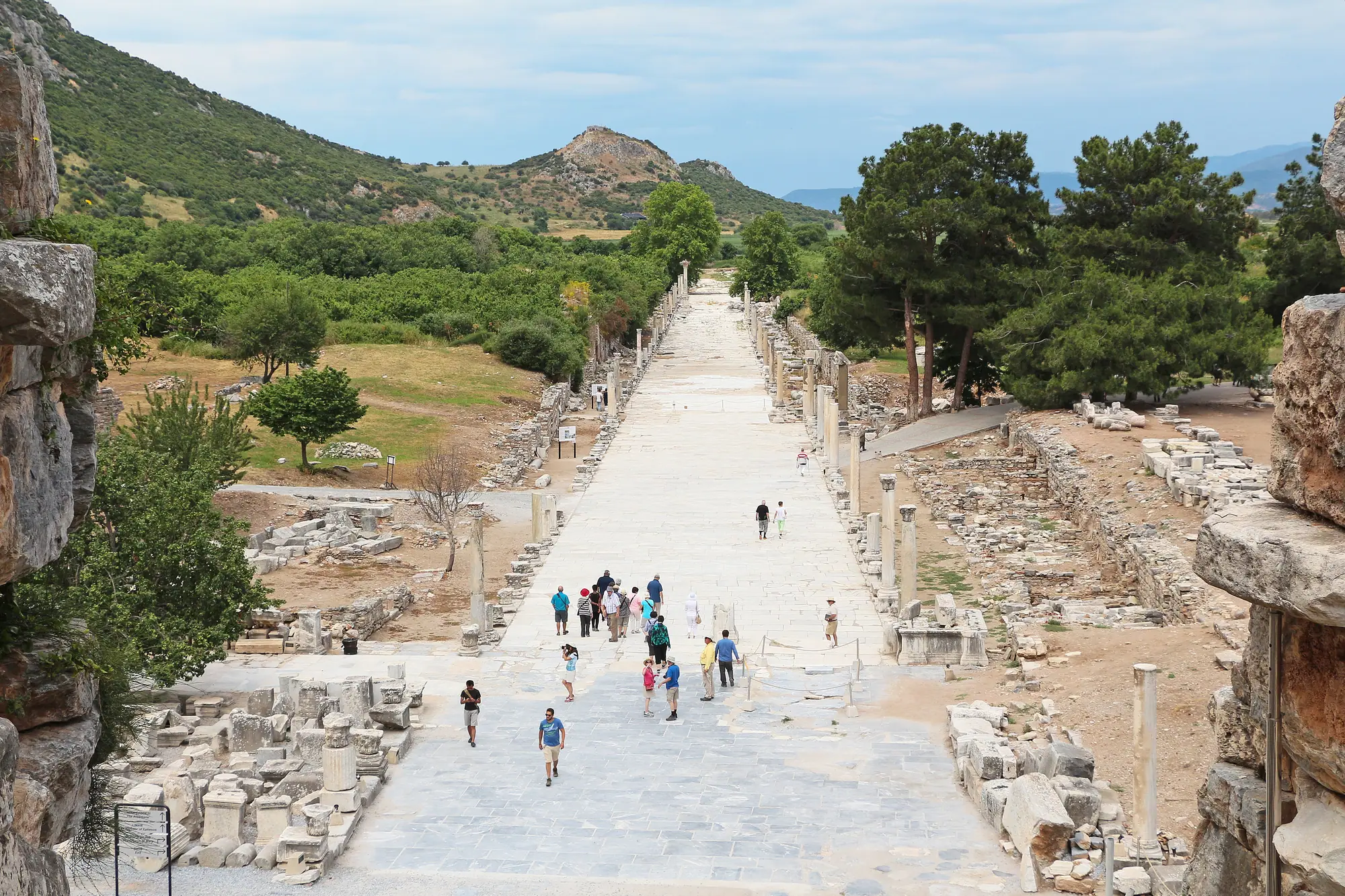
Ephesus stands on the western edge of Anatolia, beside the town of Selçuk, which has been a district in its own right within İzmir province since 19571. The ruins fill a valley between two hills, a short way south of the town and some distance inland from the Aegean2. Ticket offices stand at both ends of the site: the Lower Gate faces Selçuk from the north, and the Upper Gate closes the southern end3.
Where exactly is Ephesus?
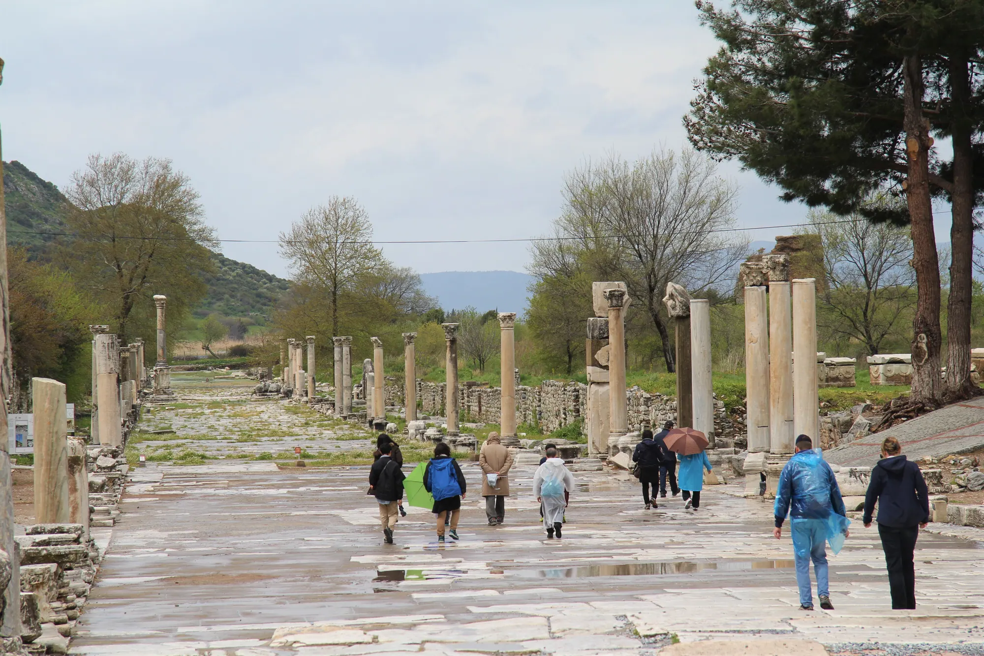
The ancient city lies in the lower valley of the Küçük Menderes, a river the Greeks knew as the Kaystros8. Its two hills had ancient names as well: Panayırdağ was Mount Pion, and Bülbüldağ was the ridge that ancient writers called Preon or Lepre Akte8. Curetes Street, the spine of the ruins, follows the dip between them downhill as far as the Library of Celsus9, and the map of Ephesus plots the whole route from one gate to the other.
Selçuk lies on the northern side, the side of the Lower Gate3. From the town’s railway station to that gate is a walk of about 3.5 km10.

What the World Heritage listing covers
UNESCO inscribed Ephesus in 2015 under criteria (iii), (iv) and (vi)11, and its current record divides the property into four pieces of ground instead of one fenced site12:
| Component | Area |
|---|---|
| Çukuriçi Höyük, the prehistoric mound | 1.5 ha11 |
| The ancient city of Ephesus | 614.76 ha11 |
| Ayasuluk Hill: the Artemision and the medieval settlement | 45.82 ha11 |
| The House of the Virgin Mary | 0.55 ha11 |
| Total, with a buffer zone of 1,246.3 ha | 662.62 ha13 |
Read as an answer to “where is Ephesus?”, the table shows that the name has covered several places. Among UNESCO’s reasons for listing it was the settlement landscape itself, shaped by a coast on the move, together with a Roman harbour city that kept its sea channel and harbour basin14.
Is Ephesus in Greece or Turkey?
Ephesus is in Turkey. People look for it in Greece because for most of antiquity it was a Greek-speaking city, and in Greek tradition its founder was Androclus, the Athenian king Codrus’s son, at the head of Ionian settlers15. Tradition dates that settlement to the 11th or 10th century BC; the oldest Iron Age Greek pottery dug up at the site belongs to the late 11th16.
Under Rome it was one of the leading cities of the province of Asia. Attalus III of Pergamon bequeathed his kingdom to Rome when he died in 133 BC, and the province took shape in 129 BC17. That province is the Asia of the New Testament. Revelation’s seven churches, with the Christians of Ephesus addressed first, all lay inside it, not in Asia as the continent is understood today18.

The names on the map today
The ruins keep the ancient name, while the town beside them is Selçuk. Its hill, Ayasuluk, carries a worn-down form of the Greek Hagios Theologos, “the Holy Theologian”, a title of St John; Italian traders made it Altologo, and Turkish speakers Ayasluğ or Ayasuluk19. The name came from the church raised over the apostle’s traditional grave, the Basilica of St John20.
Under the Turkish Republic, Selçuk was governed from Kuşadası until 1957; that year it was made a district of its own and moved to İzmir province1.

Why is Ephesus so far from the sea?
The Küçük Menderes brought down so much silt that its delta has been pushing the coast westward since about 5000 BC, and every new harbour had to be built beyond the last21. The ancient site is now about 5 km inland, and its harbour basin has shrunk to a small marshy lake4.
The distance depends on the starting point. The Roman canal ran about 4 km west from the harbour basin, a later Byzantine channel added roughly 3 km more to reach today’s shore, and Ayasuluk hill is about 9 km from the water22. A single figure in a guidebook has simply picked one of those points.
The fight against the silt lasted for centuries. By Strabo’s account, a mole that Attalus II had built to deepen the harbour mouth caught the mud instead23. Clearance campaigns are recorded from Nero’s reign into the mid-3rd century AD24, and as the delta advanced the Romans dug a long canal west from the basin to keep ships coming in25.
Why the city kept moving
Ephesus was never one settlement on one spot: as the shoreline shifted, the city and its harbours were relocated more than once21. In outline, five sites carry the story.
- c. 6700–2750 BCÇukuriçi Höyük. A Neolithic village, deserted for more than 2,500 years, resettled in the Late Chalcolithic and given up for good around 2750 BC26. In the Neolithic the shore was only some 1.5 km off, near a lagoon27.
- Late Bronze AgeAyasuluk hill. Many scholars take it to be Apaša, the Arzawan capital of Hittite texts, though the case rests on the name and on Mycenaean finds, with no inscription to confirm it28.
- 6th century BCDown to the Artemision. According to Strabo, the townspeople came down from the mountainside in Croesus’s time and settled around the temple of Artemis29.
- Early 3rd century BCThe valley between the hills. Lysimachus rebuilt the city inside new walls on the site where its Hellenistic and Roman remains stand today2.
- Middle AgesBack to Ayasuluk. Settlement drifted to the fortified hill, while parts of the old lower city stayed in use until the 12th century30.
The move under Lysimachus was the turning point in the history of Ephesus. Strabo tells it as a trick with blocked drains and a flooded town31; geoarchaeology points to the silting of the old harbour by the Artemision, at a time when the bay between the hills still had deep water32.
The ancient lower city was deserted by the 15th century33. Life went on at Ayasuluk, and that is why modern Selçuk sits on the medieval site and not on the Roman one.

Distances from nearby towns and ports
All figures below are road distances to the Lower Gate, measured on the map and not timed in traffic.
| From | Distance |
|---|---|
| Selçuk railway station | about 3.8 km by road, 3.5 km on foot10 |
| Şirince | 10 km34 |
| Kuşadası cruise port | about 19 km (23 km to the Upper Gate)5 |
| Priene | 60 km34 |
| İzmir Adnan Menderes Airport | about 62 km6 |
| İzmir Basmane station | about 79 km6 |
| Didim | 95 km34 |
| Bodrum | 173 km34 |
| Pamukkale | 199 km34 |
İzmir’s commuter railway, İZBAN, runs as far as Selçuk and is one way of getting to Ephesus, though not straight through. Trains from İzmir or the airport: change at Tepeköy35 (checked on ).
Places close to the ruins
Several places that belong to the Ephesus story lie outside the fenced ancient city.
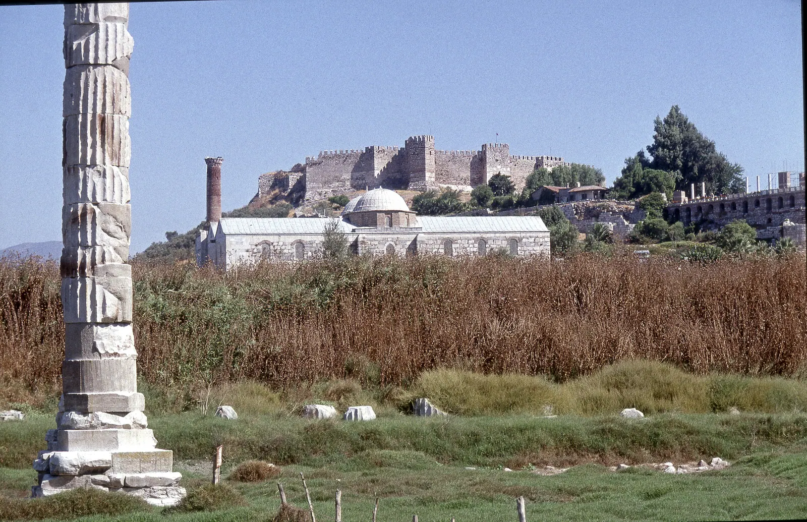
- Ayasuluk hill, above Selçuk, carries a Byzantine fortress alongside the Basilica of St John36, and the İsa Bey Mosque of 1375 stands at its foot37.
- The site of the Temple of Artemis falls within the same UNESCO component as Ayasuluk hill11. One column, pieced together from fragments, marks it today38.
- The House of the Virgin Mary is a chapel high on the mountain south of the city, around 380 m above sea level39. Drivers reach it about 5 km after leaving the Upper Gate, or after 11 km from the Lower Gate; no public transport serves it40.
- Şirince, a village in the hills, is some 8 km east of Selçuk41.
- The Mausoleum of Belevi, an early Hellenistic tomb on a massive square podium, is 14 km north-east of Ephesus42.
Each of these, and Selçuk’s own past as the medieval heir of Ephesus, has a place in around Ephesus.
Sources
Each source is listed once. The numbers link back to the claims it supports; dates show when the source was checked.
- islamansiklopedisi.org.tr › ayasuluk 1, 19, 22, 37
- www.selcuk.bel.tr › selcuk-belediyesi-tarihcesi 1
- turkisharchaeonews.net › selçuk 1, 19, 37
- www.visitizmir.org › 243 1
- Kraft, Brückner, Kayan, Engelmann 2007, Geoarchaeology 22:121-149, doi:10.1002/gea.20151 2, 8, 21, 23, 24, 25, 29, 31, 32
- Stock, Pint, Horejs, Ladstätter, Brückner 2013, Quaternary International 312:57-69 2, 21, 24, 25, 32
- web.archive.org › Ephesus 2, 19, 20, 22, 33, 37
- web.archive.org › prehellenistic-ephesos.html 2, 32
- Strabo 14.1, Loeb tr. 2, 8, 15, 23, 29, 31
- austriaca.at › 0xc1aa5576_0x001c9934.pdf 2, 19, 20, 22, 24, 25, 30, 32
- www.oeaw.ac.at › ephesos-pre-hellenistic-settlement-history 2, 32
- www.theoi.com › Pausanias1A.html 2
- OpenStreetMap nodes: Lower Gate 37.9454,27.3421; Upper Gate 37.9355,27.3462; Selçuk station 37.9509,27.3729 3
- muze.gov.tr › muze-detay 3
- turkishmuseums.com › 4 3
- turkisharchaeonews.net › harbour-ephesus 4
- whc.unesco.org › 6387 4, 11, 12, 14
- en.wikipedia.org › Ephesus 4, 7, 11, 16, 17, 20, 22, 28, 33, 37
- OSRM car/foot profiles over OpenStreetMap, our query 2026-09-14 5, 6, 10, 34, 40
- www.hzmeryemanaevi.com › location 6, 40
- www.oeaw.ac.at › Forschungsgeschichte_Ephesos.pdf 7
- tr.wikipedia.org › Efes 7, 16
- Macquarie Univ., The Coinage of Ephesus 8, 15
- turkisharchaeonews.net › curetes-street-ephesus 9
- de.wikipedia.org › Kuretenstraße 9
- web.archive.org › multiple=1 11, 12
- web.archive.org › 1018 11, 12, 13, 21
- de.wikipedia.org › Ephesos 11, 16, 28, 29
- goephesus.com › ephesus--unesco-world-heritage-centre 12
- whc.unesco.org › 1018 12
- www.worldheritagesite.org › ephesus 13, 14
- www.worldhistory.org › ephesos 15, 16, 17
- www.livius.org › ephesus 17, 28
- en.wikipedia.org › Asia_(Roman_province) 17
- bible-api.com › revelation+1:11 18
- en.wikipedia.org › Seven_churches_of_Asia 18
- www.blueguides.com › the-shifting-fortunes-of-ephesus-its-rise-and-fall-and-rise 19, 30
- en.wikipedia.org › Ayasuluk_Hill 19, 20, 36
- www.thebyzantinelegacy.com › ephesus 20, 30
- penelope.uchicago.edu › 5*.html 20
- www.oeaw.ac.at › ephesos-bio-geo-archive 21
- web.archive.org › paleography.html 22, 25
- www.britannica.com › Ephesus 22
- www.hurriyetdailynews.com › ephesus-ancient-city-meets-sea-again-28358 22
- penelope.uchicago.edu › 16*.html 24
- journals.ed.ac.uk › 6893 26, 27
- defc.acdh.oeaw.ac.at › cukurici-movie 26
- en.wikipedia.org › Çukuriçi_Höyük 26, 27
- www.ebi.ac.uk › fullTextXML 27
- Stock et al., Neolithic settlement sites… Çukuriçi & Arvalya) [abstract snippet; page 403] 27
- Meriç 2020, TÜBA-AR 27 28
- Ladstätter 2019, Ephesos from Late Antiquity until the Middle Ages, SoSchrÖAI 58:11-72) [abstract snippet] 30, 33
- web.archive.org › mittelalterforschung.html 30, 33
- en.wikipedia.org › Şirince 34, 41
- tr.wikipedia.org › Şirince 34, 41
- www.izban.com.tr › SeferSaatleri.aspx 35
- en.wikipedia.org › Selçuk_railway_station 35
- en.wikipedia.org › İZBAN 35
- muze.gov.tr › muze-detay 36
- islamansiklopedisi.org.tr › isa-bey-camii--izmir 37
- en.wikipedia.org › İsa_Bey_Mosque 37
- de.wikipedia.org › Tempel_der_Artemis_in_Ephesos 38
- en.wikipedia.org › Temple_of_Artemis 38
- Cartwright 2018 38
- www.austriaca.at › 0xc1aa5572 0x0014a7d8.pdf 39
- de.wikipedia.org › Haus_der_Mutter_Maria 39
- en.wikipedia.org › House_of_the_Virgin_Mary 40
- dergipark.org.tr › 4430684 41
- www.selcuk.gov.tr › sirince 41
- austriaca.at › 7528-5 42
- en.wikipedia.org › Belevi_Mausoleum 42